Perdrix River (Bécancour River tributary) facts for kids
Quick facts for kids Perdrix River |
|
|---|---|

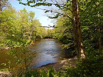
Rivière Noire in the Grandes-Coulées regional park
|
|
| Native name | Rivière Perdrix |
| Country | Canada |
| Province | Quebec |
| Region | Centre-du-Québec |
| MRC | L'Érable Regional County Municipality |
| Physical characteristics | |
| Main source | Agricultural Streams Laurierville 139 m (456 ft) 46°18′11″N 71°42′46″W / 46.30299°N 71.712656°W |
| River mouth | Noire River Notre-Dame-de-Lourdes 119 m (390 ft) 46°18′03″N 71°47′23″W / 46.30083°N 71.78972°W |
| Length | 7.9 km (4.9 mi) |
| Basin features | |
| Progression | Noire River, Bécancour River, St. Lawrence River |
| Tributaries |
|
The Perdrix River (which means partridge river in French) is a small river in Quebec, Canada. It's like a smaller stream that flows into a bigger river called the Noire River. The Noire River then joins the even larger Bécancour River, which eventually flows into the huge St. Lawrence River.
The Perdrix River flows through a few towns, including Laurierville, Plessisville (parish), and Notre-Dame-de-Lourdes. These towns are all located in the L'Érable Regional County Municipality (MRC) within the Centre-du-Québec region.
Where Does the River Start and End?
The Perdrix River begins its journey in the municipality of Laurierville. This starting point is about 3.2 kilometers (2 miles) south of the Bécancour River. It's also about 3.6 kilometers (2.2 miles) west of the center of Laurierville village.
From its source, the Perdrix River flows for about 7.9 kilometers (4.9 miles). It travels in different directions along its path:
- First, it flows west for about 1.2 kilometers (0.7 miles).
- Then, it turns northwest for about 5.1 kilometers (3.2 miles).
- Finally, it flows west again for about 1.6 kilometers (1 mile) until it reaches its end.
The Perdrix River empties into the Noire River. This meeting point is about 0.6 kilometers (0.4 miles) upstream from where another river, the Barbue River, joins the Noire River. It's also about 3.5 kilometers (2.2 miles) upstream from the Route 265 bridge in Notre-Dame-de-Lourdes.
What's in a Name?
The name "Perdrix River" comes from the French word Perdrix, which means "partridge." A partridge is a type of wild bird that is very common in Canada. So, the river is named after this bird!
The name "rivière Perdrix" was officially recognized on December 5, 1968, by the Commission de toponymie du Québec, which is like the official naming committee for places in Quebec.
 | George Robert Carruthers |
 | Patricia Bath |
 | Jan Ernst Matzeliger |
 | Alexander Miles |

