Puntapin Rock facts for kids
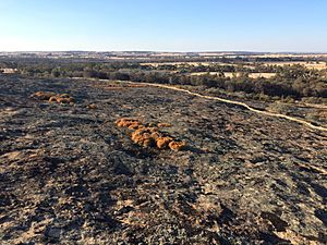
Puntapin Rock is a huge, ancient rock made of granite. You can find it about 4 kilometers (2.5 miles) southeast of Wagin, and about 30 kilometers (19 miles) west of Dumbleyung, in the western Wheatbelt area of Western Australia. It's easy to spot because it stands tall above the flat land around it.
Contents
About Puntapin Rock
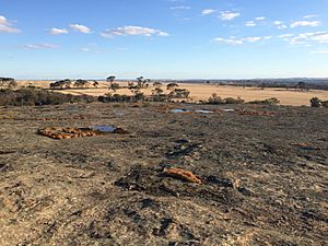
Puntapin Rock reaches a height of 310 meters (1,017 feet). Its exposed surface covers a large area of 42.5 hectares (105 acres). This rock is part of the Yilgarn Block, which is a very old part of the Earth's crust. It's mostly made of a type of granite called adamellite, which is very old and mostly the same all over. You might see some lighter colored lines running through the rock.
Water Supply for Wagin
For many years, Puntapin Rock played a super important role in providing water.
The Dam and Tank
In 1929, a dam was built on the north side of Puntapin Rock to collect rainwater. This dam was quite big, covering an area of 41 hectares (101 acres). It was built to replace an older dam, Badgarning Dam, which kept leaking. Later, a large concrete tank was built right on top of Puntapin Rock. This tank could hold a massive 675,000 liters (178,300 US gallons) of water!
Water for the Town
The people of Wagin relied on this dam for all their water needs. This continued until 1956, when the town finally got connected to the much larger Wellington Dam. Even today, water from Puntapin Dam is still mixed with the water supply from Wellington Dam.
A Place to Visit
Today, Puntapin Rock is a popular spot for visitors.
Tourist Activities
The Water Authority of Western Australia lets people visit the top of the rock. At the bottom, you'll find picnic tables, toilets, signs, and walking trails. It's a great place for a family outing or a peaceful walk.
Noongar Heritage
The traditional owners of this land are the Noongar people.
Natural Water Source
The granite dome of Puntapin Rock has many natural holes called gnamma holes. These holes collect water, making the rock a natural water catchment area. The Noongar people used these water sources for a very long time. Early sandalwood cutters and kangaroo hunters also relied on these water holes.
Dreaming Trail
Puntapin Rock is part of a special Dreaming trail. This trail stretches from the south coast, near Augusta, all the way to the Great Victoria Desert in the northeast. Other important places along this trail include Mulka's Cave (at The Humps), Wave Rock, Jilakin Rock, Jitarning Rock, and Dumbleyung Lake.
 | Anna J. Cooper |
 | Mary McLeod Bethune |
 | Lillie Mae Bradford |


