Red Top, Missouri facts for kids
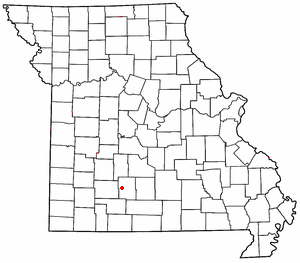
Red Top is a small, unincorporated community found in Webster County, Missouri, in the United States. An "unincorporated community" means it's a place where people live, but it doesn't have its own local government like a city or town does. Instead, it's usually governed by the county.
Red Top is part of a larger area called the Springfield Metropolitan Statistical Area. This is a fancy way of saying it's near the city of Springfield, Missouri, and is connected to its economy and community.
Where is Red Top Located?
Red Top is easy to find because it's very close to a major highway. It sits just south of Interstate 44 (I-44). You can also find it along a historic road that used to be part of the famous U.S. Route 66. This old road is now known as Missouri Supplemental Route OO.
Nearby Places
Red Top is nestled between a few other communities:
- It's about two miles northwest of a place called Northview.
- If you travel six miles southwest, you'll reach Marshfield.
- About six miles northeast, you'll find Strafford.
Natural Surroundings
A beautiful river flows near Red Top. The Pomme de Terre River passes by about one mile to the northeast of the community. Rivers are important for wildlife and can be fun places to explore!
 | Percy Lavon Julian |
 | Katherine Johnson |
 | George Washington Carver |
 | Annie Easley |


