Rivière à la Loutre (Témiscamingue) facts for kids
Quick facts for kids Rivière à la Loutre |
|
|---|---|
| Country | Canada |
| Province | Quebec |
| Region | Abitibi-Témiscamingue |
| Regional County Municipality | Témiscamingue Regional County Municipality |
| Physical characteristics | |
| Main source | Lac de l'Argentier (ex-Lake d'Argent) Fugèreville 292 m (958 ft) 47°17′00″N 79°08′05″W / 47.28333°N 79.13472°W |
| River mouth | Témiscamingue Lake Saint-Bruno-de-Guigues 172 m (564 ft) 47°31′12″N 79°28′58″W / 47.52000°N 79.48278°W |
| Length | 57.4 km (35.7 mi) |
| Basin features | |
| Progression | Témiscamingue Lake, Ottawa River |
| Tributaries |
|
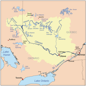
The Rivière à la Loutre, also known as the Otter River, is a river in Quebec, Canada. It flows into the upper part of the famous Ottawa River.
This river runs through the areas of Fugèreville and Saint-Bruno-de-Guigues. These towns are part of the Témiscamingue Regional County Municipality in the Abitibi-Témiscamingue region of Quebec.
Contents
Where Does the Otter River Flow?
The Otter River is part of a larger water system. A watershed is an area of land where all the water drains into one main river or lake.
Neighboring Water Areas
The areas next to the Otter River's watershed include:
- To the north: Témiscamingue Lake.
- To the east: Laverlochère River and Cameron stream.
- To the south: Témiscamingue Lake, the Ottawa River, and l'Africain stream.
- To the west: Témiscamingue Lake.
Main Tributaries of the River
A tributary is a smaller stream or river that flows into a larger one. The main tributary of the Otter River is the Laverlochère River. This river joins the Otter River from the east.
The River's Journey from Source to Mouth
The Otter River starts its journey at Lac de l'Argentier, which used to be called Lac d'Argent. This lake is about 292 meters (958 feet) above sea level. It is located west of Lac Brisebois and west of the town of Ville-Marie.
From Lac de l'Argentier, the river flows for about 57.4 kilometers (35.7 miles). It winds its way through the landscape, collecting water from many small farm streams. It even passes just south of the village of Fugèreville.
The river's journey ends when it flows into Paulson Bay. This bay is on the eastern side of Témiscamingue Lake, which is part of the Ottawa River system. The mouth of the river is about 172 meters (564 feet) above sea level.
Why is it Called Otter River?
The name "Rivière à la Loutre" means "Otter River" in English. This name was officially recognized on December 5, 1968. It was made official by the Commission de toponymie du Québec, which is the organization in Quebec responsible for naming places.


