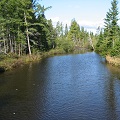
Rivière des Sept Îles facts for kids
Quick facts for kids Rivière des Sept Îles |
|
|---|---|
 |
|
| Country | Canada |
| Province | Quebec |
| Region | Capitale-Nationale, Mauricie |
| Regional County Municipality | Portneuf Regional County Municipality |
| Municipalities | Saint-Basile, Saint-Raymond |
| Physical characteristics | |
| Main source | South and east of the village of Saint-Raymond Saint-Raymond, MRC Portneuf Regional County Municipality 172 m (564 ft) 46°53′30″N 71°48′19″W / 46.8915920°N 71.8053335°W |
| River mouth | Portneuf River Saint-Basile 60 m (200 ft) 46°45′00″N 71°48′48″W / 46.7499568°N 71.813244°W |
| Length | 26.54 km (16.49 mi) |
| Basin features | |
| Tributaries |
|
The Rivière des Sept Îles is a river in Quebec, Canada. It flows into the Portneuf River. This river runs through the towns of Saint-Raymond and Saint-Basile. It is part of the Portneuf Regional County Municipality in the Capitale-Nationale region.
Most of the Rivière des Sept Îles flows through farms and forests. These areas are important for the local economy. The river is a key part of this small valley.
Roads like Boulevard du Centenaire and Chemin du Grand Rang serve the valley. These roads help people get around the area.
The river's surface usually freezes from early December to late March. It's safest to walk on the ice from late December to early March. The water level changes with the seasons and how much rain falls. The river often floods in March or April.
River's Journey
The Sept Îles river flows for about 26.54 kilometers (16.5 miles). It generally flows south towards the St. Lawrence River.
Where the River Starts
The river begins from two main sources. One is a stream south of the village of Saint-Raymond. The other is a marshy area east of the same village. This starting point is south of Mount Laura-Plamondon. It is also west of the Paquet airfield.
How the River Flows
From its marshy start in Saint-Raymond, the Sept Îles river travels a long path:
- It flows about 3.8 km (2.4 mi) south. It passes near an old dumping ground. It also goes through Lake Marcel and Lac des Bouleaux.
- Next, it travels 1.7 km (1.1 mi) southwest. Here, it crosses "Lac des Val des Pins." This lake is surrounded by a small group of houses.
- The river then makes a big loop, going east for 2.7 km (1.7 mi). It passes near the hamlet of Bourg-Louis.
- It continues south for 2.9 km (1.8 mi). It crosses the Rang de la Montagne road.
- After that, it flows southeast for 1.6 km (1.0 mi). This brings it to the edge of the Saint-Basile-Sud area.
- It keeps going southeast for 3.7 km (2.3 mi) to a small stream.
- The river then winds for 2.7 km (1.7 mi). It makes several small turns until it reaches Chemin Sainte-Angélique.
- It flows for another 4.9 km (3.0 mi) through Rang Sainte-Angélique. It passes near the border of Pont-Rouge.
- Finally, it flows 240 meters (787 ft) to where the Rivière d'Aulnage joins it.
- The river then travels 2.3 km (1.4 mi) more to its mouth. It flows into the Portneuf River. This is southeast of the village of Saint-Basile-Sud.
The Sept Îles river joins the Portneuf River on its north bank. From this meeting point, the Portneuf River flows for about 13.9 km (8.6 mi). It winds southwest through the St. Lawrence plain. It eventually reaches the north shore of the St. Lawrence River.
River's Name
The name "Rivière des Sept Îles" means "River of the Seven Islands." This name was officially recognized on December 5, 1968. It was added to the Place Names Bank of the Commission de toponymie du Québec.
 | Janet Taylor Pickett |
 | Synthia Saint James |
 | Howardena Pindell |
 | Faith Ringgold |

