San Felipe Jalapa de Díaz facts for kids
Quick facts for kids
San Felipe Jalapa de Díaz
|
|
|---|---|
|
Municipality and town
|
|
| Country | |
| State | Oaxaca |
| Area | |
| • Total | 154.38 km2 (59.61 sq mi) |
| Population
(2005)
|
|
| • Total | 25,395 |
| Time zone | UTC-6 (Central Standard Time) |
| • Summer (DST) | UTC-5 (Central Daylight Time) |
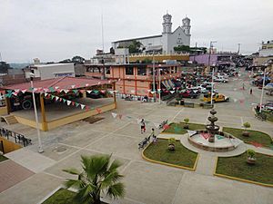
San Felipe Jalapa de Díaz is a town in the Mexican state of Oaxaca. It is also the name of the area around the town, called a municipality. Think of a municipality like a county or a local government area.
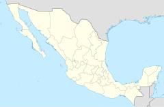
This town is about 50 kilometers (about 31 miles) west of Tuxtepec. It is part of the Tuxtepec District and the Papaloapan Region in Oaxaca.
Contents
Geography of San Felipe Jalapa de Díaz
Where is San Felipe Jalapa de Díaz Located?
The municipality sits at an altitude of 140 meters (about 460 feet) above sea level. It covers an area of 154.38 square kilometers (about 59.6 square miles). The town is located on the left bank of the Santo Domingo River.
What is the Climate Like?
The climate here is hot all year round. The average temperature is about 24.7 °C (76.5 °F). Most of the rain falls during the months of June, July, August, September, and October.
Plants and Trees in the Area
The forested areas around San Felipe Jalapa de Díaz are home to many different kinds of trees. You can find fig, avocado, mahogany, oak, and cedar trees. Other trees include limaloe, palm, and ceiba hormiguillo.
Animals You Might See
The municipality is also home to various wildlife. Some of the animals living here are deer, brocket deer, and jaguars. You might also spot white-tailed deer, gray foxes, porcupines, armadillos, and raccoons.
Communities in the Municipality
The municipality includes several smaller communities. These are like small villages or neighborhoods within the larger area. Some of them are:
- Agua de Olla
- Agua de Tierra (Sección la Montaña)
- Arroyo Cacao
- Arroyo Culebra
- Arroyo Espuma
- Arroyo Guaje
- Arroyo Seco (San José Arroyo Seco)
- Arroyo Venado (Sección Tercera)
- Arroyo Zapotillo
- Camino de Ixcatlán
- Camino Zacatal
- Chuparrosa
- Colonia la Central
- Colonia San Andrés
- Desviación Cerro Quemado
- Desviación Paso Carretero
- La Concha
- La Gloria
- La Permuta
- La Soledad
- La Sorpresa
- Llano Grande Uluápam
- Loma Cafetal
- Loma de San Juan
- Loma Naranja
- Los Zárates
- Paso Carretero
- Paso del Toro
- Playa Chica
- Rancho de la Playa
- Santo Tomás
- Sección Arroyo Crecido
- Sección la Montaña (Agua de Tierra)
- Sección Lavida
- Sección los Bibiano
- Sección los Castro
- Sección los Hernández
- Sección los Palacios
- Sección los Roques
Economy: How People Make a Living
Main Jobs and Activities
The main way people earn money in San Felipe Jalapa de Díaz is through farming. They grow many different crops, including coffee, corn, beans, and sugar cane. People also grow medicinal plants and fodder, which is food for farm animals.
Raising Animals and Other Work
Some people in the municipality raise animals like cattle, goats, and pigs. A few people also hunt and fish, but usually just to feed themselves and their families. Another common activity is weaving at home, where people create textiles.
Demographics: Who Lives Here?
Population and Languages Spoken
As of 2005, there were 5,035 homes in the municipality. The total number of people living there was 25,395. A large number of these residents, about 20,654 people, speak an indigenous language. This means they speak a language that has been used in this region for a very long time.
See also
 In Spanish: San Felipe Jalapa de Díaz para niños
 | Precious Adams |
 | Lauren Anderson |
 | Janet Collins |


