San Marcos, Guerrero facts for kids
Quick facts for kids
San Marcos
|
|
|---|---|
 |
|
| Country | |
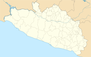
| State | Guerrero |
| Municipality | San Marcos |
| Founded | 28 September 1885 |
| Elevation | 30 m (100 ft) |
| Population | |
| • Total | 12,000 |
| Time zone | UTC-6 (Central) |
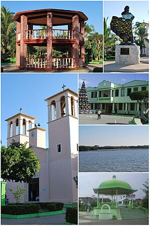
San Marcos is a town located in the Mexican state of Guerrero. It is the main town, also known as the municipal seat, for the larger San Marcos area.
About 12,000 people live in San Marcos today. The town and its surrounding area are part of a special cultural region in Mexico. This region is called the Costa Chica, which means "small coast." It stretches for about 125 kilometers (78 miles) along the Pacific coast. The Costa Chica starts south of Acapulco and goes all the way to Puerto Ángel in the nearby state of Oaxaca.
Geography
San Marcos is located about 59 kilometers (37 miles) south of Acapulco. It is about an hour's drive away. The town is 18 kilometers (11 miles) inland from the coast. You can find it along Federal Highway 200. This road is also known as the Acapulco–Pinotepa Nacional highway. From San Marcos, it takes about three hours to drive 157 kilometers (98 miles) to Pinotepa Nacional.
History
The town and municipality of San Marcos were officially created on September 28, 1885. It was named in honor of Saint Mark, a Catholic saint. Many people in the region consider him their patron saint. However, the town existed even before this official date. It was first known by the name Xolutla. Later, it was called La Estancia before finally becoming San Marcos.
See also
 In Spanish: San Marcos (Guerrero) para niños


