Santa Cruz District, León Cortés Castro facts for kids
Quick facts for kids
Santa Cruz
|
|
|---|---|
|
District
|
|
| Country | |
| Province | San José |
| Canton | León Cortés Castro |
| Area | |
| • Total | 21.97 km2 (8.48 sq mi) |
| Elevation | 1,650 m (5,410 ft) |
| Population
(2011)
|
|
| • Total | 1,665 |
| • Density | 75.79/km2 (196.28/sq mi) |
| Time zone | UTC−06:00 |
| Postal code |
12005
|
Santa Cruz is a special area called a district in Costa Rica. It is part of the León Cortés Castro canton, which is in the San José province.
Contents
About Santa Cruz
Where is Santa Cruz?
Santa Cruz is located in the beautiful country of Costa Rica. It is part of the San José province.
Size and Height
The district of Santa Cruz covers an area of about 21.97 square kilometers. That's like a square with sides about 4.7 kilometers long! It is also quite high up, at an elevation of 1650 meters above sea level. This means it's located in a mountainous or hilly area.
Villages in Santa Cruz
Santa Cruz is home to several smaller communities, often called villages or poblados. These include:
- Cedral (part of it)
- Lucha (part of it)
- San Martín
- Rincón Gamboa
People of Santa Cruz
Population Numbers
Knowing the population helps us understand how many people live in an area. This is called demographics.
| Historical population | |||
|---|---|---|---|
| Census | Pop. | %± | |
| 1950 | 303 | — | |
| 1963 | 1,022 | 237.3% | |
| 1973 | 1,556 | 52.3% | |
| 1984 | 1,503 | −3.4% | |
| 2000 | 1,626 | 8.2% | |
| 2011 | 1,665 | 2.4% | |
|
Instituto Nacional de Estadística y Censos |
|||
According to the census taken in 2011, Santa Cruz had a population of 1665 people.
Getting Around Santa Cruz
Roads and Routes
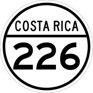
The district has roads that help people travel. One important road that passes through Santa Cruz is:
- National Route 226
See also
 In Spanish: Santa Cruz de León Cortés Castro para niños


