
Santa Rosa historic landmarks facts for kids
Santa Rosa is a city in California that cares about its history! To make sure important places are remembered and protected, the city has a special list of "historic landmarks." These are buildings, signs, or areas that have a unique story or are very old.
A group called the Cultural Heritage Board suggests which places should become landmarks. Then, the City Council makes the final decision. These local landmarks are special to Santa Rosa and are different from state or national historic places.
Contents
Santa Rosa's Special Historic Places
Santa Rosa has many cool places that tell stories from the past. Here are some of them:
Rosenberg Building
The Rosenberg Building is an old and important building located at 306 Mendocino Avenue. It was recognized as a landmark in 1989. This building helps us remember what Santa Rosa looked like a long time ago.

Luther Burbank Home & Gardens
This is a very famous landmark! It was the home and gardens of Luther Burbank, a world-famous plant scientist. He created many new types of plants right here in Santa Rosa. The home and gardens are located at the southeast corner of Santa Rosa and Sonoma Avenues. It became a landmark in 1991 and is also a National Historic Landmark, meaning it's important to the whole country! You can visit it today.

Rosenberg Department Store
Not to be confused with the Rosenberg Building, the Rosenberg Department Store was a big shopping spot at 700 Fourth Street. It became a landmark in 1994. Today, a bookstore is the main tenant in this historic building.

Church of One Tree
This church has an amazing story! It's called the "Church of One Tree" because it was built almost entirely from a single giant redwood tree. It was originally located at Ross and B Streets. In 1957, the City of Santa Rosa moved the entire church to its current spot at 492 Sonoma Avenue, in Juilliard Park. It became a landmark in 1998 and is now available to rent for special events.

Fountaingrove Round Barn
The Fountaingrove Round Barn was a unique building located at 3535 Round Barn Boulevard. It was recognized as a landmark in 2000. This special barn was a famous part of Santa Rosa's landscape for many years.
Images for kids
-
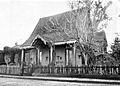
First house built by Europeans in Santa Rosa, California.

