Sierra Valley facts for kids
Sierra Valley is a large valley located in the mountains of California. It sits east of the Sierra Nevada mountain range, stretching across parts of Plumas and Sierra Counties. You can find it north of Interstate 80.
Contents
Exploring Sierra Valley's Geography
Sierra Valley is a special kind of valley, meaning it's nestled right between mountains. It sits about 4,850 feet (1,478 meters) above sea level. The mountains around it are quite tall, reaching from 6,000 to 8,000 feet (1,829 to 2,438 meters) high.
How Sierra Valley Was Formed
This huge valley covers about 590 square miles (1,528 square kilometers). It's a deep dip in the land that formed when parts of the Earth's crust moved downwards. Long, long ago, about 10,000 years ago, Sierra Valley was actually a big lake! This ancient lake, sometimes called Lake Beckwourth, was formed in a similar way to Lake Tahoe, which is to the south. Over thousands of years, the lake filled up with sediment, which is like mud and sand, sometimes as thick as two thousand feet.
Weather and Wildlife in the Valley
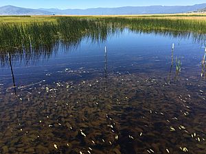
Sierra Valley doesn't get a lot of rain, usually less than twenty inches each year. Most of this falls as snow during the colder months. The valley floor is covered with grasslands and sagebrush plants. It also has many freshwater marshes, which are wet areas filled with tall plants like cattails and bulrushes. There are also some dry, flat areas that can be a bit salty. All the water from these areas eventually flows into the Middle Fork Feather River.
Many different animals live in Sierra Valley all year round. It's also a very important stop for many types of birds that migrate, or travel, long distances. These birds stop here in the fall on their way south and come back in the spring to build their nests. The valley even has some natural hot springs, like Marble Hot Springs, located in the middle of the northern part of the valley floor.
What People Do in Sierra Valley: Economy
Sierra Valley is an important area for farming and raising livestock, like cattle. Many people also visit the valley for tourism, which helps the local economy.
Getting to Sierra Valley: Access Routes
There are a few main ways to get into Sierra Valley. If you're coming from the west, you'll likely use State Route 49, which goes through Yuba Pass. From the east, you can enter through Beckwourth Pass on State Route 70. Beckwourth Pass is the lowest mountain pass in the Sierra Nevada range. State Route 89 also runs along the southern edge of the valley.
State Route 49, which is known as the Gold Rush trail, ends at State Route 70 in a small place called Vinton. State Route 70 then continues on through Chilcoot before ending at Hallelujah Junction, where it meets U.S. Route 395.
Main Towns in Sierra Valley
- Sierraville
- Beckwourth
- Calpine
- Sattley
- Loyalton
- Vinton
- Chilcoot
 | James Van Der Zee |
 | Alma Thomas |
 | Ellis Wilson |
 | Margaret Taylor-Burroughs |


