Slieve Bloom Way facts for kids
Quick facts for kids Slieve Bloom Way |
|
|---|---|

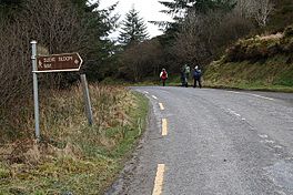
Trail on R440 road
|
|
| Length | 84 kilometres (52 miles) |
| Location | Counties Laois & Offaly, Ireland |
| Designation | National Waymarked Trail |
| Trailheads | Glenbarrow |
| Use | Hiking |
| Elevation gain/loss | +1,275 m (4,183 ft) |
| Difficulty | Strenuous |
| Season | Any |
The Slieve Bloom Way is a special long walking path in Ireland. It goes all the way around the beautiful Slieve Bloom Mountains. This path is about 84 kilometers (52 miles) long.
It is a circular route, meaning it starts and ends in the same place. The journey begins and finishes at Glenbarrow, which is close to the village of Rosenallis in County Laois. Most people take about four days to walk the entire Slieve Bloom Way.
Contents
What is the Slieve Bloom Way?
The Slieve Bloom Way is known as a National Waymarked Trail. This means it is a recognized and well-marked path for walkers. The National Trails Office of the Irish Sports Council officially named it this way.
Many groups help to look after the trail. These include the local councils of Laois and Offaly. Other groups like Laois Integrated Development Company, Coillte (which manages forests), and the Slieve Bloom Development Association also help.
How the Trail Started
A local person named Tom Joyce came up with the idea for the Slieve Bloom Way. The path was first opened in 1987. It was created as part of a bigger plan to make the Slieve Bloom area a special European Environment Park. This happened during the European Year of the Environment.
Exploring the Trail: A Journey Through Nature
The Slieve Bloom Way takes you through many different landscapes. It offers amazing views and a chance to see nature up close. The path is known for being challenging, so it's best for experienced hikers.
Key Sections of the Path
The journey starts at Glenbarrow. From there, the trail goes up to the Ridge of Capard. This ridge offers wide-open views of the area. After that, the path goes down to a road near Monicknew Bridge.
You will then walk through forests on the sides of Gorteenameale mountain. The trail also follows an old route over the Glendine Gap. This part is below Arderin, which is the highest mountain in the Slieve Bloom range.
The path then follows the River Camcor until it reaches a small area called Glenregan. You will cross the Silent River Valley and climb up Spink hill. After that, the trail goes down into the Glenkeen Valley. The last part of the journey crosses Glendineoregan and Knocknastumba. Finally, it reaches the banks of the River Barrow, which leads you back to Glenbarrow.
 | Stephanie Wilson |
 | Charles Bolden |
 | Ronald McNair |
 | Frederick D. Gregory |

