St Saviourgate facts for kids

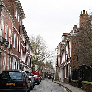
View along St Saviourgate
|
|
| Former name(s) | Ketmongergate |
|---|---|
| Location | York, United Kingdom |
| Coordinates | 53°57′35″N 1°04′41″W / 53.9597°N 1.0780°W |
| North east end |
|
| South west end |
|
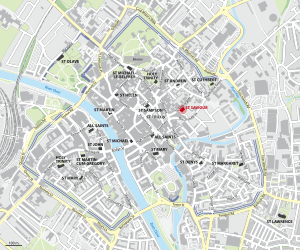
St Saviourgate is a historic street in the city of York, England. It is famous for its old buildings and interesting past. The street was first mentioned in the year 1175.
History of St Saviourgate

The area where St Saviourgate is located was just outside the city walls of Roman Eboracum (which was the Roman name for York). This area was north of a marshy part near the River Foss.
When people dug foundations for new houses in the 1600s, they found many animal horns. This suggests there might have been a Roman temple nearby.
The street was first called "Ketmongergate" in 1175. This name meant "street of the meat sellers." St Saviour's Church was built here in the 11th century. By the year 1368, the street had taken its name from the church.
St Saviourgate became a key place for different Protestant churches in York. These churches were called nonconformist because they did not follow the main Church of England. The York Unitarian Chapel was built in 1693. The Salem Chapel, for a group called Congregationalists, was built in 1839. The Central Methodist Church followed in 1840.
Many buildings on the street were rebuilt in the 1700s. In 1777, the street was made wider.
Buildings and Layout
St Saviourgate runs from the meeting point of Colliergate and Whip-Ma-Whop-Ma-Gate. It goes north-east to where Spen Lane and St Saviour's Place meet. St Saviour's Place used to be considered part of St Saviourgate.
On the north-west side of the street, you can find the Methodist and Unitarian churches. There is also a masonic hall, which was once a place for working people to learn new skills. Other old houses from the 1700s are at numbers 27, 29, 31, 33, and 35. Numbers 1-7 used to be a department store.
On the south-east side, you will see the back of Stonebow House. You can also find St Saviour's Church here, which is now home to the Jorvik DIG centre. This centre lets you explore archaeology. Other notable buildings include Lady Hewley's Almshouses and a row of houses at 16-22 St Saviourgate, built in 1740. There are also other 18th-century houses at 24, 26, 30, and 32. Number 34 St Saviourgate has parts that date back to the 1400s.

