
Suratá facts for kids
Quick facts for kids
Suratá
|
||
|---|---|---|
|
Municipality and town
|
||
 |
||
|
||

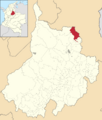
Location of the municipality and town of Suratá in the Santander Department of Colombia
|
||
| Country | ||
| Department | Santander Department | |
| Time zone | UTC-5 (Colombia Standard Time) | |
.svg)
Suratá is a town and municipality located in the Santander Department in northeastern Colombia. It is a place with a unique climate.
Contents
What is the Climate Like in Suratá?
Suratá has a mild and humid climate. This is because of its location in the mountains. The weather changes depending on the elevation.
Average Temperatures in Suratá
The average temperatures in Suratá are usually warm. They stay fairly steady throughout the year. The highest temperatures are around 22-25 degrees Celsius. The lowest temperatures are around 12-14 degrees Celsius.
Rainfall and Humidity in Suratá
Suratá gets a good amount of rain each year. Some months are much wetter than others. April, May, September, and October often have the most rain. The air is also quite humid, meaning there is a lot of moisture in the air.
Sunshine in Suratá
Even with the rain, Suratá still gets a good amount of sunshine. There are many sunny hours throughout the year. This helps plants grow and keeps the area green.
| Climate data for Suratá (Vivero Surata), elevation 1,725 m (5,659 ft), (1981–2010) | |||||||||||||
|---|---|---|---|---|---|---|---|---|---|---|---|---|---|
| Month | Jan | Feb | Mar | Apr | May | Jun | Jul | Aug | Sep | Oct | Nov | Dec | Year |
| Mean daily maximum °C (°F) | 22.7 (72.9) |
23.1 (73.6) |
23.2 (73.8) |
22.8 (73.0) |
22.6 (72.7) |
22.8 (73.0) |
22.9 (73.2) |
23.0 (73.4) |
22.4 (72.3) |
21.9 (71.4) |
21.9 (71.4) |
22.2 (72.0) |
22.6 (72.7) |
| Daily mean °C (°F) | 17.5 (63.5) |
18.0 (64.4) |
18.0 (64.4) |
17.8 (64.0) |
17.9 (64.2) |
18.0 (64.4) |
17.8 (64.0) |
17.8 (64.0) |
17.4 (63.3) |
17.2 (63.0) |
17.3 (63.1) |
17.4 (63.3) |
17.7 (63.9) |
| Mean daily minimum °C (°F) | 12.4 (54.3) |
13.0 (55.4) |
13.3 (55.9) |
13.6 (56.5) |
13.9 (57.0) |
13.8 (56.8) |
13.3 (55.9) |
13.5 (56.3) |
13.3 (55.9) |
13.2 (55.8) |
13.0 (55.4) |
12.7 (54.9) |
13.2 (55.8) |
| Average precipitation mm (inches) | 18.1 (0.71) |
31.0 (1.22) |
58.9 (2.32) |
143.4 (5.65) |
157.4 (6.20) |
72.8 (2.87) |
52.0 (2.05) |
89.2 (3.51) |
147.2 (5.80) |
200.8 (7.91) |
110.7 (4.36) |
36.3 (1.43) |
1,117.8 (44.01) |
| Average precipitation days | 5 | 7 | 10 | 16 | 17 | 12 | 13 | 16 | 20 | 20 | 15 | 8 | 159 |
| Average relative humidity (%) | 81 | 80 | 82 | 86 | 87 | 85 | 83 | 84 | 85 | 88 | 88 | 84 | 85 |
| Mean monthly sunshine hours | 210.8 | 177.8 | 170.5 | 132.0 | 133.3 | 144.0 | 167.4 | 155.0 | 132.0 | 124.0 | 141.0 | 182.9 | 1,870.7 |
| Mean daily sunshine hours | 6.8 | 6.3 | 5.5 | 4.4 | 4.3 | 4.8 | 5.4 | 5.0 | 4.4 | 4.0 | 4.7 | 5.9 | 5.1 |
| Source: Instituto de Hidrologia Meteorologia y Estudios Ambientales | |||||||||||||
| Climate data for Suratá (Cachiri), elevation 1,850 m (6,070 ft), (1981–2010) | |||||||||||||
|---|---|---|---|---|---|---|---|---|---|---|---|---|---|
| Month | Jan | Feb | Mar | Apr | May | Jun | Jul | Aug | Sep | Oct | Nov | Dec | Year |
| Mean daily maximum °C (°F) | 24.7 (76.5) |
25.3 (77.5) |
25.0 (77.0) |
24.3 (75.7) |
23.7 (74.7) |
23.6 (74.5) |
24.1 (75.4) |
24.2 (75.6) |
24.3 (75.7) |
23.7 (74.7) |
23.4 (74.1) |
23.7 (74.7) |
24.2 (75.6) |
| Daily mean °C (°F) | 18.6 (65.5) |
18.7 (65.7) |
18.7 (65.7) |
18.5 (65.3) |
18.5 (65.3) |
18.5 (65.3) |
18.6 (65.5) |
18.7 (65.7) |
18.5 (65.3) |
18.2 (64.8) |
18.3 (64.9) |
18.4 (65.1) |
18.5 (65.3) |
| Mean daily minimum °C (°F) | 13.1 (55.6) |
13.3 (55.9) |
13.8 (56.8) |
14.3 (57.7) |
14.6 (58.3) |
14.4 (57.9) |
14.1 (57.4) |
14.2 (57.6) |
14.1 (57.4) |
14.1 (57.4) |
14.1 (57.4) |
13.5 (56.3) |
14.0 (57.2) |
| Average precipitation mm (inches) | 30.4 (1.20) |
45.4 (1.79) |
80.9 (3.19) |
150.3 (5.92) |
145.7 (5.74) |
66.8 (2.63) |
39.2 (1.54) |
72.7 (2.86) |
126.4 (4.98) |
180.4 (7.10) |
135.1 (5.32) |
49.2 (1.94) |
1,122.7 (44.20) |
| Average precipitation days | 6 | 8 | 11 | 17 | 17 | 12 | 10 | 14 | 18 | 20 | 15 | 8 | 155 |
| Average relative humidity (%) | 81 | 81 | 81 | 84 | 84 | 84 | 83 | 82 | 83 | 85 | 85 | 83 | 83 |
| Mean monthly sunshine hours | 207.7 | 175.0 | 164.3 | 129.0 | 124.0 | 129.0 | 158.1 | 155.0 | 138.0 | 130.2 | 150.0 | 179.8 | 1,840.1 |
| Mean daily sunshine hours | 6.7 | 6.2 | 5.3 | 4.3 | 4.0 | 4.3 | 5.1 | 5.0 | 4.6 | 4.2 | 5.0 | 5.8 | 5.0 |
| Source: Instituto de Hidrologia Meteorologia y Estudios Ambientales | |||||||||||||
Images for kids
-

A night view of Suratá park.
-

The flag of Suratá.
-
Map showing Suratá's location in Santander, Colombia.
See also
 In Spanish: Suratá para niños
