Te Kawa railway station facts for kids
Quick facts for kids
Te Kawa railway station
|
|||||||||||
|---|---|---|---|---|---|---|---|---|---|---|---|

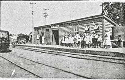
Te Kawa railway station in 1934
|
|||||||||||
| Location | New Zealand | ||||||||||
| Coordinates | 38°05′35″S 175°17′01″E / 38.093093°S 175.283518°E | ||||||||||
| Elevation | 48 m (157 ft) | ||||||||||
| Line(s) | North Island Main Trunk | ||||||||||
| Distance | Wellington 506.88 km (314.96 mi) | ||||||||||
| History | |||||||||||
| Opened | 9 March 1887 | ||||||||||
| Closed | 17 October 1971 | ||||||||||
| Electrified | June 1988 | ||||||||||
| Services | |||||||||||
|
|||||||||||
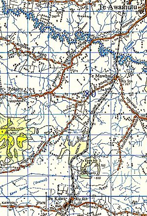
Te Kawa railway station was once an important stop on New Zealand's main railway line. This line is called the North Island Main Trunk. The station was located in a place called Te Kawa. It helped connect people and goods across the North Island for many years.
Contents
Building the Te Kawa Railway Line
The railway line that went through Te Kawa was a big project. To the north of the station, the tracks had to cross a very large swamp. This swamp was known as Te Kawa Swamp. Workers built a raised path, like a long, low bridge, for the tracks to sit on.
Engineers also made sure to include special tunnels under the railway. These tunnels were called culverts. They helped water flow through the swamp. They also protected traditional eel weirs, which were special traps used by Māori to catch eels.
What Happened at Te Kawa Station?
The Te Kawa station opened on March 9, 1887. It quickly became a busy place. By 1909, a post office was open nearby. This meant people could send and receive mail easily.
The station also helped local businesses. A special group was set up to manage water in the area. This group was called a drainage board. By 1915, the station was handling goods for Waikeria Prison. This prison was located nearby.
Future Plans for Te Kawa
For a while, people thought Te Kawa might become an even bigger railway hub. In 1908, there were ideas to build new railway lines from Te Kawa. These lines would go to places like Kawhia Harbour and Raglan.
Later, in 1920, there was another idea. This plan was for a railway line connecting Kawhia to Rotorua. Te Kawa would have been a key junction on this new route. However, these plans never happened.
The Railway Line's Path
The railway line to the south of Te Kawa station had a gentle slope. This slope was a "1 in 183 gradient." This means for every 183 meters the train traveled forward, it went down 1 meter.
In the 1970s and 1980s, the station had a special side track. This track was called a private siding. It was used by a local business to load grain onto trains.
The Station's End
Te Kawa railway station closed its doors on October 17, 1971. After many years of service, the station building and land were sold. This happened in the year 2000. Even though the station is gone, the main railway line still runs through Te Kawa today.
 | Delilah Pierce |
 | Gordon Parks |
 | Augusta Savage |
 | Charles Ethan Porter |


