Waimanalo Beach, Hawaii facts for kids
Quick facts for kids
Waimānalo Beach
|
|
|---|---|

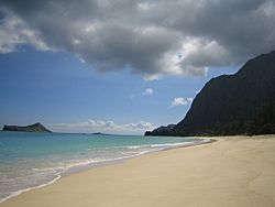
The beach at Waimānalo on windward Oʻahu
|
|

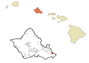
Location in Honolulu County and the state of Hawaiʻi
|
|
| Country | United States |
| State | Hawaiʻi |
| Area | |
| • Total | 2.96 sq mi (7.68 km2) |
| • Land | 1.98 sq mi (5.12 km2) |
| • Water | 0.99 sq mi (2.56 km2) |
| Elevation | 16 ft (5 m) |
| Population
(2020)
|
|
| • Total | 4,823 |
| • Density | 2,442.03/sq mi (942.83/km2) |
| Time zone | UTC-10 (Hawaii-Aleutian) |
| Area code(s) | 808 |
| FIPS code | 15-78200 |
| GNIS feature ID | 0364777 |
Waimānalo Beach is a small community located in Honolulu County, Hawaiʻi. It's on the island of Oʻahu, which is part of the U.S. state of Hawaiʻi. This area is known as a census-designated place (CDP), which means it's a special area defined by the government for counting people.
Waimānalo Beach is on the "windward" side of Oʻahu. This means it's on the side that faces the wind, often getting more rain. However, this specific community has a rather dry climate. In 2020, about 4,823 people lived here. It's very close to the town of Waimānalo, and they often feel like one big community.
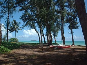
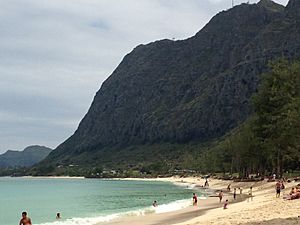
The town of Waimānalo Beach sits along the eastern part of the actual Waimānalo Beach. This beach is super long, stretching for almost 5.5 miles (8.9 km). It's the longest sandy beach on Oʻahu! You won't find many big shops or hotels here. It's known for its local feel and is close to other cool spots like Makapuʻu Beach and Sea Life Park.
The postal code for Waimānalo Beach and Waimānalo is 96795.
Contents
History and Interesting Facts
World War II Connection
An important event from World War II happened right on Waimānalo Beach. On December 8, 1941, the day after the surprise attack on Pearl Harbor, a Japanese soldier named Kazuo Sakamaki was captured here. He became the very first prisoner of war taken by U.S. forces during the war.
Famous TV Show Location
If you've ever watched the old TV series Magnum, P.I., you might recognize a place in Waimānalo Beach. The Anderson Estate, which was shown as "Robin's Nest" in the show, is located in this area.
Geography of Waimānalo Beach
Waimānalo Beach is found at these coordinates: 21°20′1″N 157°41′53″W / 21.33361°N 157.69806°W. The nearby town of Waimānalo is to its west.
The total area of Waimānalo Beach is about 7.7 square kilometers (3.0 sq mi). A large part of this area, about 2.6 square kilometers (1.0 sq mi), is water. The land area is around 5.1 square kilometers (2.0 sq mi). This means about 33.45% of the total area is water.
Population and People
| Historical population | |||
|---|---|---|---|
| Census | Pop. | %± | |
| 2020 | 4,823 | — | |
| U.S. Decennial Census | |||
In 2020, the population of Waimānalo Beach was 4,823 people. The community is known for being very diverse. In 2000, for example, many residents were of Pacific Islander heritage, and a good number were from two or more racial backgrounds.
The average household in 2000 had about 4.25 people living in it, showing that many families are quite large. The median age of people living here was 35 years old.
Education
The Hawaii Department of Education is in charge of the public schools in Hawaiʻi. Blanche Pope Elementary School, which serves younger students, is located right in the Waimānalo Beach area.
See also
 In Spanish: Waimanalo Beach para niños
 | Valerie Thomas |
 | Frederick McKinley Jones |
 | George Edward Alcorn Jr. |
 | Thomas Mensah |


