
Wildlife Trust for Bedfordshire, Cambridgeshire and Northamptonshire facts for kids

The Wildlife Trust for Bedfordshire, Cambridgeshire and Northamptonshire (WTBCN) is a charity that looks after nature. They manage 126 special places called nature reserves. These reserves cover a huge area, about 3,945 hectares (that's like 9,750 football fields!).
Over 35,000 people are members of this trust. It's amazing because 95% of people in Bedfordshire, Cambridgeshire, and Northamptonshire live very close to one of these reserves. The trust works to protect wildlife, encourage people to help nature, and share knowledge about the environment. It's one of many wildlife trusts across the UK, all working together for nature.
Contents
How the Trust Started
The idea to protect special natural places began way back in 1912. A man named Charles Rothschild created a group called the Society for the Promotion of Nature Reserves. Their goal was to save important natural sites.
Later, in 1949, a law called the National Parks and Access to the Countryside Act helped protect these places. By 1959, the society started helping local wildlife trusts all over Britain. By 1978, there were local trusts covering the whole country! In 2004, the main society changed its name to The Wildlife Trusts.
Our local trust, the WTBCN, grew over time. It started with the Cambridgeshire and Isle of Ely Naturalists’ Trust in 1956. Then came the Bedfordshire and Huntingdonshire Wildlife Trust in 1961, and the Northamptonshire Wildlife Trust in 1963. These groups joined together over the years, forming the Wildlife Trust for Bedfordshire, Cambridgeshire and Northamptonshire in 1994.
What Makes a Nature Reserve Special?
Many of the trust's nature reserves have special titles because they are so important for wildlife.
- 52 reserves are Sites of Special Scientific Interest (SSSI). This means they are protected by law because of their unique plants, animals, or geology.
- Six are Ramsar wetland sites. These are wetlands that are important all over the world, especially for birds.
- Six are Special Protection Areas (SPA). These are places where rare or migrating birds are protected.
- Two are national nature reserves (NNR). These are the most important places for wildlife in the country.
The biggest reserve is Ouse Washes, which is 186 hectares. It's super important for birds like wildfowl and waders that visit in winter or come to breed. The smallest reserves are Chettisham Meadow and Stoke Wood End Quarter, both just 0.7 hectares, but still very important!
Nature Reserves to Explore
The Wildlife Trust manages many amazing places. Here's a look at some of them and what makes them special.
Key to Designations and Access
Designations
|
Public Access
|
Bedfordshire Reserves
| Site | Photograph | Area | Public access | Designations | Description |
|---|---|---|---|---|---|
| Blow's Downs | 62.3 hectares (154 acres) | YES | SSSI | This site has many different habitats. It has a large area of natural grassland. You can also see a disused quarry and old medieval farming terraces. It's home to a very rare plant and a rare beetle! | |
| Flitwick Moor (& Folly Wood) | 66.6 hectares (165 acres) | YES | SSSI | This is the biggest wetland area in Bedfordshire. It's a rich valley mire, which is a type of bog. Eight kinds of sphagnum bog moss grow here, including one that is nationally rare. You'll also find woodlands and wet grasslands. | |
| Pegsdon Hills and Hoo Bit | 79.0 hectares (195 acres) | YES | SSSI, CAONB | These chalk hills have beautiful wildflower meadows. Look for orchids and moschatels. Many butterflies live here, like dingy and grizzled skippers. Birds like wheatears and skylarks also call this place home. |


Cambridgeshire Reserves
| Site | Photograph | Area | Public access | Designations | Description |
|---|---|---|---|---|---|
| Brampton Wood | 132 hectares (330 acres) | YES | SSSI | This is one of the oldest woodlands in the county. It's a wet forest with ash and maple trees on heavy clay soil. The paths through the wood have many different grassland flowers. | |
| Cherry Hinton Chalk Pits | 11 hectares (27 acres) | YES | LNR, SSSI | These two areas used to be chalk quarries. Now, they are wildflower grasslands with some bushes. You can find flowers like harebell and the rare moon carrot here. One part has steep, old woodland with ash and cherry trees. | |
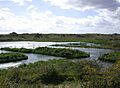
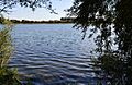
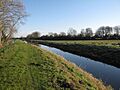
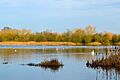
| Ouse Washes | 186 hectares (460 acres) | YES | NCR, Ramsar, SAC, SPA, SSSI | The Ouse Washes are super important for wildfowl and waders from all over the world. Many birds, like teal and wigeons, come here in winter or to breed. The site also has lots of water plants and animals, plus natural grasslands. |


Northamptonshire Reserves
| Site | Photograph | Area | Public access | Designations | Description |
|---|---|---|---|---|---|
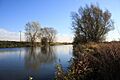
| Ditchford Lakes and Meadows | 31.1 hectares (77 acres) | YES | Ramsar, SPA, SSSI | This site has lakes that used to be gravel pits. Now, they are home to many birds that visit in winter or breed here, like Cetti's warblers and oystercatchers. You might even spot otters in the lakes! There are also grasslands and willow bushes. | |
| Glapthorn Cow Pastures | 28.0 hectares (69 acres) | YES | SSSI | This reserve has ash and maple woodlands, and thick blackthorn bushes. It's one of the most important places in Britain for the black hairstreak butterfly. These butterflies need blackthorn plants to lay their eggs. The bushes also provide nesting spots for nightingales. | |
| Summer Leys | 47.0 hectares (116 acres) | YES | LNR, Ramsar, SPA SSSI, | This wetland has lakes from old gravel pits, with special hides for birdwatching. You'll also find grasslands, hedges, and wet meadows. Birds like golden plovers and common terns breed here. Butterflies like common blues and the less common brown argus also live here. |


Images for kids
-
Arlesey Old Moat
-
Barton Gravel Pit
-
Begwary Brook
-
Cooper's Hill
-
Cople Pits
-
Cut-throat Meadow
-
Dropshort Marsh
-
Fancott Woods and Meadows
-
Felmersham Gravel Pits
-
King's Wood and Rammamere Heath
-
Lancot Meadow
-
Landpark Wood
-
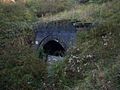
Old Warden Tunnel
-
Pavenham Osier Beds
-
The Riddy
-
Sallowsprings
-
Sewell Cutting
-
Sharnbrook Summit
-
Totternhoe
-
Wymington Meadow
-
Arthur's Meadow
-
Beechwoods
-
Buff Wood
-
Cambourne Nature Reserve
-
Chettisham Meadow
-
Doghouse Grove
-
Dogsthorpe Star Pit
-
Fordham Woods
-
Fulbourn Fen
-
Gamlingay Cinques
-
Gamlingay Wood
-
Gamsey Wood
-
Godmanchester Nature Reserve
-
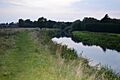
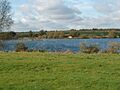
Grafham Water
-
Great Fen
-
Hardwick Wood
-
Hayley Wood
-
Houghton Meadows
-
Lady's Wood
-
Lattersey
-
Lower Wood
-
Norwood Road
-
Overhall Grove
-
Pingle Cutting
-
Raveley Wood
-
Shepherd's Close
-
Shepreth L Moor
-
Skaters' Meadow
-
Soham Meadow
-
Southorpe Meadow
-
Southorpe Paddock
-
Stanground Newt Ponds
-
Stanground Wash
-
Thorpe Wood
-
Trumpington Meadows
-
Upwood Meadows
-
Wansford Pasture
-
Waresley Wood
-
Wistow Wood
-
Woodston Ponds
-

Woodwalton Marsh
-
Abington Meadows
-
Barford Wood and Meadows
-
Barnes Meadow
-
Boddington Meadow
-
Bradlaugh Fields
-
Bugbrooke Meadow
-
Collyweston Quarries
-
Duston Mill Meadow
-
Farthinghoe
-
Finedon Cally Banks
-
Grafton Regis Meadow
-
Great Oakley Meadow
-
Harlestone Heath
-
High Wood and Meadow
-
Higham Ferrers Pits
-
Irthlingborough Lakes and Meadows
-
King's Wood
-
Kingsthorpe Meadow
-
Lings
-
Mill Crook
-
Old Sulehay
-
Pitsford Water
-
The Plens
-
Ramsden Corner
-
Rothwell Gullet
-
Short Wood and Southwick Wood
-
Southfield Farm Marsh
-
Stoke Bruerne Brick Pits
-
Stoke Wood End Quarter
-
Storton's Pits
-
Tailby Meadow
-
Titchmarsh
-
Wicksteed Park
-
Wilson's Pits
-
Woodford Halse


