Achagoyle Bay facts for kids
Quick facts for kids Achagoyle Bay |
|
|---|---|

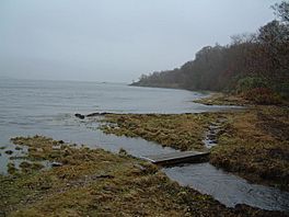
High Tide on the heritage trail Walking along the edge of Achagoyle Bay from the car park at Minard, the first bridge you come to on the Brainport Heritage Trail.
|
|
| Location | Minard |
| Coordinates | 56°06′51″N 5°15′12″W / 56.114044°N 5.253345°W |
| Type | sea loch bay |
| River sources | Alltan Tosdach Auchgoyle Burn |
| Islands | An Oitir Eilean Aoghainn Eilean Fraoch Brideagan |
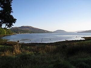
Achagoyle Bay is a small bay, or inlet, on the coast of Scotland. It is located on the western side of Loch Fyne. Loch Fyne is the longest sea loch in Scotland.
Achagoyle Bay is in an area called Argyll and Bute. It is about 0.75 miles wide. The bay faces a certain direction, which is 114 degrees. This means it opens towards the southeast.
Achagoyle Bay is connected to two other bays. It is just northwest of Brainport Bay. Brainport Bay then opens into Minard Bay. These three bays together form the western edge of the Minnow Narrows. This narrow part of the loch is bordered by two islands, An Oitir and Eilean Aoghainn.
Where is Achagoyle Bay?
The small village of Minard is located right at the northwest corner of Achagoyle Bay. It's a quiet spot by the water.
What is the Geography Like?
Achagoyle Bay is surrounded by beautiful nature. A large hill called Beinn Ghlas stands to the north. This hill is 420 meters tall. It is one of the "Marilyns" in southern Scotland. A Marilyn is a hill in the British Isles that is at least 150 meters high.
Beinn Ghlas forms a long ridge that runs alongside Loch Fyne. Most of the land around Achagoyle Bay is covered in thick forests.
Ancient History at Brainport Bay
Just south of Achagoyle Bay, on Brainport Bay, there's an interesting ancient site. It's a structure from the Bronze Age. This means it's from around 3,500 years ago!
Archaeologists dug up this site in the 1970s. They found some very unusual stone structures. These structures seemed to be set up in a special way.
- There was a flat area, like a platform, around a natural rock.
- Two large boulders stood upright. These are called "observation boulders."
- Between these boulders was a flat, cobbled area.
- There was also a main platform, which looked like it was made even better by people.
It seems this main platform was used as an amazing sighting device. Two tall, thin standing stones, over 1 meter high, once stood here. They were placed in cracks between rocks. Even though they have fallen now, these stones would have lined up perfectly. They pointed to a notch, or dip, between two mountains far away. These mountains were about 30 miles northeast along the loch.
During the Bronze Age, people used these stones to track the sun. At midsummer sunrise, the sun would appear just to the left of the north. It would then cross the exact line of the stones. A few minutes later, it would pass just above the notch in the distant mountains. The stones were designed so that even on cloudy days, you could still see the alignment. This helped people keep track of the seasons and important dates.


