Aguas Zarcas volcanic field facts for kids
Quick facts for kids Aguas Zarcas volcanic field |
|
|---|---|
| Highest point | |
| Elevation | 621 metres (2,037 ft) (Morera hillock) |
| Listing | List of volcanoes in Costa Rica |
| Geology | |
| Age of rock | Holocene |
| Mountain type | Volcanic field |
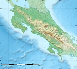
The Aguas Zarcas volcanic field is a special area in Costa Rica. It is found in the Aguas Zarcas district, which is part of the San Carlos area in the Alajuela province. This field is not one big volcano. Instead, it is a group of many smaller, cone-shaped hills. These hills are actually old volcanoes called pyroclastic cones. They were formed by eruptions of ash and rock fragments.
What is the Aguas Zarcas Volcanic Field?
This volcanic field is located on the northern side of the Platanar Volcano. It has at least nine cone-shaped hills. One of these is a larger hill, and the other eight are smaller ones. These smaller hills are often called "hillocks."
The sides of these cones are usually quite steep. They slant between 10 and 30 degrees. The cones are often long and stretched out from east to west. The whole group of cones runs from north to south. This shape suggests that the area was formed by movements in the Earth's crust. Some of the cones also show signs of old lava flows. This means that lava once flowed from them.
Hills and Hillocks of the Volcanic Field
The Aguas Zarcas volcanic field has several interesting hills and hillocks. Each one has its own unique features.
- Los Chiles hill: This is one of the larger hills. It is also known as Altamira. There is a big quarry here, where rocks are dug out. The eastern side of the hill is covered with trees and plants. The land around it is used to grow pineapples.
- Valle Hermoso hillock: This hillock is quite flat compared to the others. It is surrounded by fields where cattle graze.
- Vuelta de Kopper hillock: This hillock is named after a nearby town. It is very large and has an elongated shape. You can find a path that leads to the top of this hill.
- Pital hillock: This hillock is very old and has been worn down by weather over time. It is located close to the town of Pital.
- Barrantes hillock: At the top of this hillock, there is a quarry. The rest of the hill is covered by a thick forest. There is also a path that goes up to the top.
- Juan Murillo hillocks: You can still see parts of a crater on these hillocks. They are about 2 kilometers (1.2 miles) northeast of the town center. This makes them easy to spot. There is also a quarry at the bottom of these hills.
- Morera hillocks: Like the Juan Murillo hillocks, these also have remains of a crater. They are about 2 kilometers (1.2 miles) southeast of the town center. You can find a path to reach the top.
- Buenos Aires hillock: This hillock used to be a quarry. But now, plants and trees have grown back on its sides. There is a path to the top. It is right next to Route 140. The town of Buenos Aires is on the other side of the road.
See also
 In Spanish: Campo volcánico de Aguas Zarcas para niños
- List of volcanoes in Costa Rica
 | Kyle Baker |
 | Joseph Yoakum |
 | Laura Wheeler Waring |
 | Henry Ossawa Tanner |


