Alabak Island facts for kids

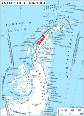
Location of Graham Coast on the Antarctic Peninsula
|
|
|
Location in Antarctica
|
|
| Geography | |
|---|---|
| Location | Antarctica |
| Coordinates | 65°59′25″S 64°43′50″W / 65.99028°S 64.73056°W |
| Administration | |
| Administered under the Antarctic Treaty System | |
| Demographics | |
| Population | Uninhabited |
Alabak Island (which is Ostrov Alabak in Bulgarian) is a small island in Antarctica. Most of the island is covered in ice and it has hills. It is located in a place called Barilari Bay. This bay is part of the Graham Coast in Graham Land.
The island stretches about 1.35 kilometers (0.84 miles) from east to west. It is also about 670 meters (0.42 miles) wide. The eastern end of the island is called Huitfeldt Point. Alabak Island is separated from the Velingrad Peninsula by a passage. This passage is about 500 meters (1,640 feet) wide. It formed because a glacier melted a lot in the late 1900s.
The island got its name from Alabak Ridge. This ridge is a mountain range in Southern Bulgaria.
Where is Alabak Island Located?
Alabak Island is in a very cold and remote part of the world. It is about 4.74 kilometers (2.95 miles) southeast of Vorweg Point. It is also 11.15 kilometers (6.93 miles) southwest of Duyvis Point. Duyvis Point is on the Felipe Solo (Obligado) Peninsula. British explorers mapped this area in 1971.
See also
 In Spanish: Isla Alabak para niños
 | Leon Lynch |
 | Milton P. Webster |
 | Ferdinand Smith |


