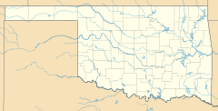
Albany, Oklahoma facts for kids
Quick facts for kids
Albany, Oklahoma
|
|
|---|---|
| Country | United States |
| State | Oklahoma |
| County | Bryan |
| Area | |
| • Total | 4.16 sq mi (10.76 km2) |
| • Land | 4.11 sq mi (10.63 km2) |
| • Water | 0.05 sq mi (0.13 km2) |
| Elevation | 581 ft (177 m) |
| Population
(2020)
|
|
| • Total | 118 |
| • Density | 28.74/sq mi (11.10/km2) |
| Time zone | UTC-6 (Central (CST)) |
| • Summer (DST) | UTC-5 (Central Daylight (CDT)) |
| ZIP code |
74721
|
| Area code(s) | 580 |
| FIPS code | 40-00950 |
| GNIS feature ID | 2629903 |
Albany is a small community located in Bryan County, Oklahoma, United States. It is found on State Highway 70E. Albany is known as a census-designated place (CDP). This means it's an area that the U.S. Census Bureau identifies for collecting population data. It is also an unincorporated community, which means it doesn't have its own local government like a city or town.
History of Albany
The post office in Albany first opened a long time ago, on July 10, 1894. The community was named after Albany, New York. It was common for new places to be named after older, well-known cities or the hometowns of settlers.
Population and Demographics
The word "demographics" means the study of a population. This includes how many people live in a place and how that number changes over time.
| Historical population | |||
|---|---|---|---|
| Census | Pop. | %± | |
| 2020 | 118 | — | |
| U.S. Decennial Census | |||
According to the 2020 census, Albany had 118 residents. This number was a bit smaller than its population of 143 people in 2010. The telephone area code for Albany is 580.
See also
 In Spanish: Albany (Oklahoma) para niños
 | Mary Eliza Mahoney |
 | Susie King Taylor |
 | Ida Gray |
 | Eliza Ann Grier |


