Bryan County, Oklahoma facts for kids
Quick facts for kids
Bryan County
|
|
|---|---|
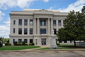
Bryan County Courthouse
|
|
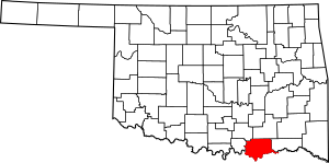
Location within the U.S. state of Oklahoma
|
|
 Oklahoma's location within the U.S. |
|
| Country | |
| State | |
| Founded | 1907 |
| Seat | Durant |
| Largest city | Durant |
| Area | |
| • Total | 944 sq mi (2,440 km2) |
| • Land | 904 sq mi (2,340 km2) |
| • Water | 39 sq mi (100 km2) 4.2%% |
| Population
(2020)
|
|
| • Total | 46,067 |
| • Density | 48.800/sq mi (18.842/km2) |
| Time zone | UTC−6 (Central) |
| • Summer (DST) | UTC−5 (CDT) |
| Congressional district | 2nd |
Bryan County is a county in the state of Oklahoma. A county is like a smaller region within a state. In 2020, about 46,067 people lived here. Its main town, or county seat, is Durant. Bryan County is special because it's the only county in the whole United States named after a famous politician, William Jennings Bryan.
Bryan County is part of the Durant, Oklahoma, area. This area is also part of the larger Dallas-Fort Worth and Texoma regions. The main office for the Choctaw Nation of Oklahoma is in Durant.
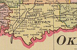
Bryan County has 10 smaller areas called Townships. These are Albany, Bennington, Bokchito, Brown, Caddo, Calera, Colbert, Kemp, Matoy, and Speairs.
Contents
History of Bryan County
The land that is now Bryan County was first settled by the Choctaw tribe. They moved here in 1831 and 1832. After they set up their government in the Indian Territory, much of this area became part of Blue County. This was a section of the Pushmataha District of the Choctaw Nation.
In 1845, the Choctaw tribe opened Armstrong Academy. This was a school for boys near the town of Bokchito. During the Civil War, this academy was also the Choctaw capital, called Chahta Tamaha.
Another school, Bloomfield Academy, opened in 1852. This school was for Chickasaw girls. It was located just south of the town of Achille.
Before the Chickasaw tribe moved to Indian Territory, they bought some land from the Choctaw. The western part of what is now Bryan County became part of the Chickasaw District in 1837. In 1855, the Choctaw and Chickasaw tribes officially became separate nations. The Chickasaw District then became the Chickasaw Nation.
Travel and Conflict in the Past
In the late 1850s, the Butterfield Overland Mail and Stage route passed through this area. This was an important path for mail and travelers. During the Civil War, General Albert Pike built Fort McCulloch for the Confederate Army. This fort was near the town of Kenefic on the Blue River. No big battles happened here. But over a thousand Native American soldiers, who supported the Confederates, were stationed at the fort.
After the Civil War, new towns started to grow. This happened when the Missouri, Kansas and Texas Railway (Katy) built a train line through the area in 1872. One of these new towns was Colbert. It became the main town of Blue County and the biggest town in the Choctaw Nation. Later, in 1903, another railroad, the St. Louis, San Francisco and New Orleans Railroad, built an east-west line.
Forming Bryan County
Just before Oklahoma became a state, all tribal governments were ended. Blue County was no longer a county. On November 16, 1907, Bryan County was officially created. Durant was chosen as its county seat.
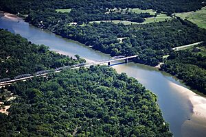
In 1931, there was a small disagreement called the Bridge War. It was also known as the Red River Bridge War. This was a peaceful argument between Oklahoma and Texas. It was about a toll bridge and a new free bridge over the Red River. The river forms the border between Grayson County, Texas and Bryan County, Oklahoma.
Geography of Bryan County
Bryan County is in southeastern Oklahoma. It's part of a 10-county area called Choctaw Country. This area is known for tourism. The county covers about 944 square miles. About 904 square miles are land, and 39 square miles (4.2%) are water.
The county is in a flat area called the Coastal Plains. Most of its water drains into the Blue River. The Washita River used to drain much of the western part of the county. Now, it flows into Lake Texoma. This lake forms most of the county's southern border. Bryan County is a big part of the Texoma region.
Main Roads
Neighboring Counties
- Atoka County (north)
- Choctaw County (east)
- Lamar County, Texas (southeast)
- Fannin County, Texas (south)
- Grayson County, Texas (southwest)
- Marshall County (west)
- Johnston County (northwest)
People of Bryan County
| Historical population | |||
|---|---|---|---|
| Census | Pop. | %± | |
| 1910 | 29,854 | — | |
| 1920 | 40,700 | 36.3% | |
| 1930 | 32,277 | −20.7% | |
| 1940 | 38,138 | 18.2% | |
| 1950 | 28,999 | −24.0% | |
| 1960 | 24,252 | −16.4% | |
| 1970 | 25,552 | 5.4% | |
| 1980 | 30,535 | 19.5% | |
| 1990 | 32,089 | 5.1% | |
| 2000 | 36,534 | 13.9% | |
| 2010 | 42,416 | 16.1% | |
| 2020 | 46,067 | 8.6% | |
| U.S. Decennial Census 1790-1960 1900-1990 1990-2000 2010 |
|||
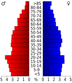
In 2000, there were 36,534 people living in Bryan County. By 2020, the population had grown to 46,067 people. This shows that more people are choosing to live in Bryan County.
Economy of Bryan County
The main parts of Bryan County's economy are farming, tourism, making things, and sending goods.
Fun Places to Visit
Many people visit Bryan County for fun. Popular spots include Lake Texoma, Lake Durant, the Choctaw Casino Resort, Choctaw Casino Bingo, and Fort Washita.
Major Employers
Some of the biggest employers in the area are the Choctaw Nation of Oklahoma. Other large employers include the J.C. Potter meat processing facility and Cardinal Glass Industries. There's also an AllianceHealth Durant hospital and a Big Lots distribution center. First United Bank and First Texoma National Bank have their main offices here. Indian Nation Wholesale and Wal-Mart also provide many jobs.
Communities in Bryan County
City
- Durant (This is the county seat, the main town.)
Towns
Census-Designated Places (CDPs)
These are areas that are like towns but are not officially organized as cities or towns.
- Albany
- Blue
- Cartwright
- Platter
- Sand Point
- Utica
Other Small Communities
These are smaller places that are not officially organized towns or CDPs.
Historic Places in Bryan County
The following places in Bryan County are listed on the National Register of Historic Places. This means they are important historical sites.
- Bloomfield Academy Site, near Achille
- Armstrong Academy Site, near Bokchito
- Caddo Community Building, Caddo
- Colbert's Ferry Site, near Colbert
- Durant Downtown Historic District, Durant
- Bryan County Courthouse, Durant
- Robert E. Lee School, Durant
- Oklahoma Presbyterian College, Durant
- Robert Lee Williams Public Library, Durant
- J. L. Wilson Building, Durant
- Carriage Point (Fisher's Station), Durant
- Roberta School Campus, Durant
- State Highway No. 78 Bridge at the Red River, near Karma
- Fort McCulloch, near Kenefic
- Nail's Station, near Kenefic
- Fort Washita, near Nida
See also
 In Spanish: Condado de Bryan (Oklahoma) para niños
 | Bessie Coleman |
 | Spann Watson |
 | Jill E. Brown |
 | Sherman W. White |


