Cartwright, Oklahoma facts for kids
Quick facts for kids
Cartwright, Oklahoma
|
|
|---|---|
|
Rural Community
|
|
|
Top to bottom, left to right:
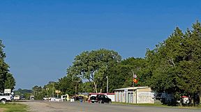
Viewing east on Oklahoma State Highway 91 in Cartwright, the city's United States Postal Service post office, and the Texoma Inn |
|
| Country | |
| State | |
| County | Bryan |
| Area | |
| • Total | 2.371 sq mi (6.14 km2) |
| • Land | 2.37 sq mi (6.1 km2) |
| • Water | 0.01 sq mi (0.03 km2) |
| Elevation | 666 ft (203 m) |
| Population
(2010)
|
|
| • Total | 609 |
| Time zone | UTC-6 (Central (CST)) |
| • Summer (DST) | UTC-5 (CDT) |
| ZIP code |
74731
|
| Area code(s) | 580 |
| GNIS feature ID | 2629910 |
Cartwright is a small, unincorporated rural community in Bryan County, Oklahoma, United States. This means it's a group of homes and businesses that isn't officially a city or town with its own local government. It's also a census-designated place, which is an area that the U.S. Census Bureau defines for gathering population data.
In 2010, about 609 people lived in Cartwright. The community got its own post office on April 25, 1940, making it one of the newer places in Bryan County. Its ZIP code is 74731.
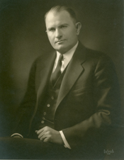
Cartwright was named after a man named Wilburn Cartwright, who was a Congressman. The community started because of the construction of the Denison Dam. Workers building the dam needed a place to live, so shelters were built, and that's how Cartwright began.
Life in Cartwright
Cartwright is a quiet place. Most houses in the area were built around 1983. The average temperature in Cartwright is about 62.5 degrees Fahrenheit (16.9 degrees Celsius).
See also
 In Spanish: Cartwright (Oklahoma) para niños
 | William M. Jackson |
 | Juan E. Gilbert |
 | Neil deGrasse Tyson |


