Washita River facts for kids
Quick facts for kids Washita River |
|
|---|---|

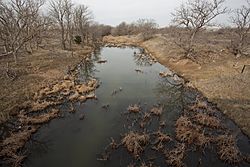
Upper Washita River in Hemphill County, Texas
|
|

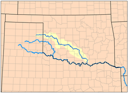
Map of the Washita River watershed
|
|
| Other name(s) | Ouachita, False Washita |
| Country | United States |
| Physical characteristics | |
| Main source | Roberts County, Texas 3,028 ft (923 m) 35°37′32″N 100°35′46″W / 35.6256003°N 100.5962467°W |
| River mouth | Lake Texoma 617 ft (188 m) 33°54′42″N 96°34′41″W / 33.9117669°N 96.5780504°W |
| Length | 295 mi (475 km) |
| Basin features | |
| River system | Red River |
| Basin size | 7,870 sq mi (20,400 km2) |


The Washita River is a long river in the United States. It flows through the states of Texas and Oklahoma. This river is about 295 miles (475 km) long. It ends when it joins the Red River. Today, this meeting point is part of Lake Texoma, located right on the border between Texas and Oklahoma.
Contents
Exploring the Washita River's Path
The Washita River begins in eastern Roberts County, Texas. This is near the town of Miami in the Texas Panhandle. The river then flows across Hemphill County, Texas.
It enters Oklahoma in Roger Mills County. From there, it travels through many Oklahoma counties. These include Custer, Washita, Caddo, Grady, Garvin, Murray, Carter, and Johnston. Finally, it empties into Lake Texoma. This lake forms the border between Bryan County and Marshall County.
River Features and Surroundings
The Washita River flows through the middle of the Anadarko Basin. This area holds the fifth-largest amount of natural gas in the United States. When the river reaches the Arbuckle Mountains, it drops quickly. It cuts through a deep limestone gorge called Big Canyon. This canyon is about 300 feet (91 meters) deep.
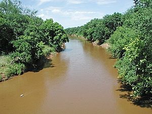
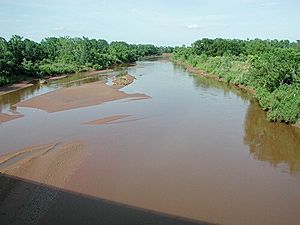
The river's bottom is made of soft mud and sand. Its banks are steep and made of red earth that easily wears away. Because of this, the Washita River carries a lot of silt (fine dirt and sand). It is one of the most silt-filled rivers in North America.
Water Sources and Reservoirs
Along its journey, the Washita River is held back by the Foss Dam. This dam creates the Foss Reservoir in Custer County, Oklahoma. Several other lakes in the Washita River valley store water from smaller streams that flow into the river. These include Fort Cobb Lake, Lake Chickasha, and Arbuckle Reservoir.
A Look Back: History of the Washita River
French explorers first found the Washita River in the early 1700s. They were traveling up the Red River. They thought it might be the same river that friendly Choctaw people had described to them, called the Ouachita River.
However, they soon saw that this river looked very different. So, they named it the Faux Ouachita, which means "False Ouachita." Later, English-speaking American settlers called it the False Washita. After the American Civil War, people simply called it the Washita.
Fort Washita's Role
In 1842, Zachary Taylor, who would later become a President, built Fort Washita. This fort was near the lower part of the river. Its purpose was to protect the Choctaw and Chickasaw nations. These Native American groups had been moved from the southeastern United States. The fort helped protect them from the Plains Indians who lived in the area. It was about 19 miles (31 km) upstream from where the Washita and Red rivers meet.
Important Events in History
During the later Indian Wars, a significant event happened near the Washita River. This was the Battle of Washita River on November 27, 1868. At dawn, Lt. Col. George Armstrong Custer and his 7th U.S. Cavalry attacked a Cheyenne village. This village, led by Black Kettle, was located on the Washita River near what is now Cheyenne, Oklahoma. Many people in the village died during this conflict.
Later, from September 9–14, 1874, Capt. Wyllys Lyman's wagon train faced an attack by Native Americans. This happened near the Washita in Hemphill County.
 | Sharif Bey |
 | Hale Woodruff |
 | Richmond Barthé |
 | Purvis Young |

