Anderson, South Dakota facts for kids
Quick facts for kids
Anderson, South Dakota
|
|
|---|---|
| Country | United States |
| State | South Dakota |
| County | Minnehaha |
| Area | |
| • Total | 0.77 sq mi (1.98 km2) |
| • Land | 0.77 sq mi (1.98 km2) |
| • Water | 0.00 sq mi (0.00 km2) |
| Elevation | 1,450 ft (440 m) |
| Population
(2020)
|
|
| • Total | 388 |
| • Density | 506.53/sq mi (195.68/km2) |
| Time zone | UTC-6 (Central (CST)) |
| • Summer (DST) | UTC-5 (CDT) |
| Area code(s) | 605 |
| GNIS feature ID | 2584543 |
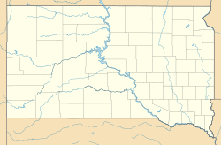
Anderson, also known as Anderson Subdivision, is a small place in Minnehaha County, South Dakota, USA. It's called an "unincorporated community" because it's a group of homes that isn't officially a town or city. It's also a "census-designated place," which means the government counts its population for official records.
In 2020, about 388 people lived in Anderson. This community is located to the east of a larger city called Sioux Falls.
Geography of Anderson
Anderson is a small area of land. According to the U.S. Census Bureau, it covers about 0.77 square miles (1.98 square kilometers). Almost all of this area is land, with only a tiny bit being water.
People Living in Anderson
The number of people living in Anderson is counted by the U.S. Census Bureau every ten years. In the year 2020, the census showed that 388 people lived in Anderson.
See also
 In Spanish: Anderson (Dakota del Sur) para niños
 | Sharif Bey |
 | Hale Woodruff |
 | Richmond Barthé |
 | Purvis Young |


