Annenkov Island facts for kids
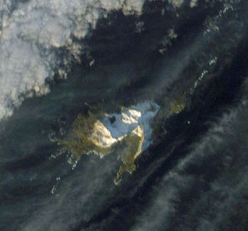
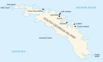
Annenkov Island is a small, rocky island located near South Georgia. It sits to the west of the main South Georgia island. The island has an irregular shape and is about 4 miles (6.4 km) long. Its highest point reaches about 650 meters (2,130 feet) high. Annenkov Island is found about 8 miles (13 km) off the south-central coast of South Georgia. The Pickersgill Islands are located to its southeast.
Contents
History of Annenkov Island
Who Discovered Annenkov Island?
Annenkov Island was first found in January 1775 by a British journey led by James Cook. Cook named it Pickersgills Island after Lieutenant Richard Pickersgill. He was an officer on Cook's ship, the HMS Resolution.
How Did Annenkov Island Get Its Name?
Later, in 1819, a Russian journey led by Fabian Gottlieb von Bellingshausen found the island again. Bellingshausen thought he was the first to discover it. He named it Annenkov Island after Lieutenant Mikhail Annenkov, an officer on his ship, the Vostok. The name Pickersgill is now used for a group of islands about 15 miles (24 km) to the southeast. These are known as the Pickersgill Islands.
Wildlife on Annenkov Island
Why is Annenkov Island Special for Wildlife?
Annenkov Island is a very special place for wildlife. It is one of the few islands in the South Georgia area that has always been free of rats. This is important because rats can harm native wildlife. The main island of South Georgia had a big effort to remove rats, which was very successful.
What Animals Live on Annenkov Island?
Even though the island has "not a single shrub nor any vegetation," it is home to many birds. About 500 pairs of wandering albatrosses come here to breed. These large seabirds are known for their huge wingspans.
Geography and Geology of Annenkov Island
What Does Annenkov Island Look Like?
Annenkov Island is a very rocky place with many ridges and hills. The highest point on the island is Olstad Peak. This peak rises to about 650 meters (2,130 feet) high.
How Were Features on the Island Named?
Olstad Peak was mapped between 1951 and 1957. It was named by the United Kingdom Antarctic Place-Names Committee for Ola Olstad. He was a Norwegian zoologist who explored the area in the late 1920s. The island also has other rocky features. These include the McPherson Crags, which are about 460 meters (1,510 feet) high. There are also ridges and hills like Albatross Crest, Lawther Knoll, Pettigrew Scarp, and Bareback Ridge. You can also find a rock pillar called Spilite Arch on the northeast side of the island.
Are There Lakes on Annenkov Island?
Yes, the island has freshwater lakes. One of them is Intrusion Lake. It is about 0.2 miles (0.32 km) long and is located in the center of the island. This lake was mapped in the early 1970s. Its unusual shape is due to different types of rock found along its northern edge. Another lake, Fan Lake, is formed by melting ice and is in the southeast part of the island.
What is Around Annenkov Island?
The island has several important points and bays. First Point is in the northwest. Rustad Bay and South West Point are in the southwest. The island is also surrounded by reefs. These include Hauge Reef and Low Reef to the east. There are also rocky areas like Horror Rock and Mislaid Rock to the west.
See also
 In Spanish: Isla Annenkov para niños
 | Dorothy Vaughan |
 | Charles Henry Turner |
 | Hildrus Poindexter |
 | Henry Cecil McBay |


