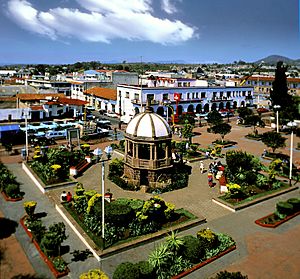
Atlacomulco de Fabela facts for kids
Quick facts for kids
Atlacomulco de Fabela
Mbado (in Otomi)
|
|
|---|---|
|
Municipal Seat
|
|

=
|
|
| Country | |
| State | Mexico |
| Municipality | Atlacomulco |
| Elevation | 2,596 m (8,517 ft) |
| Population
(2010)
|
|
| • Total | 22,774 |
| Time zone | UTC-6 (Central Standard Time) |
| • Summer (DST) | UTC-5 (Central Daylight Time) |
| Postal code (of seat) |
50360
|
| INEGI code | 1500140001 |
Atlacomulco de Fabela is a town in Mexico. It is the main town, also known as the "municipal seat," of the Atlacomulco Municipality. This municipality is located in the State of Mexico.
Contents
What's in a Name?
The name Atlacomulco comes from the Nahuatl language. It means "place where there are ditches." This name tells us about the geography of the area.
The town also has names in other local languages. In Otomi, it is called Mbado. In Mazahua, it is known as Mbaro. These different names show the rich history and diverse cultures in the region.
Where is Atlacomulco?
Atlacomulco de Fabela is located in the central part of Mexico. It is part of the State of Mexico, which is one of the 32 states in the country.
The town sits at a high elevation. It is about 2,596 meters (or 8,517 feet) above sea level. This means it is located in a mountainous or high-altitude area.
How Many People Live Here?
According to information from 2010, about 22,774 people live in Atlacomulco de Fabela. This number helps us understand the size of the town.
Time and Location
Atlacomulco uses the North American Central Time Zone. This is the same time zone as many other places in central Mexico and the central United States.
- During standard time, it is 6 hours behind UTC (UTC-6).
- During daylight saving time, it is 5 hours behind UTC (UTC-5).
The town's exact location can be found using its coordinates: 20°5′54″N latitude and 99°49′37″W longitude. These numbers help pinpoint its spot on a map.
See also
 In Spanish: Atlacomulco de Fabela para niños
 | William Lucy |
 | Charles Hayes |
 | Cleveland Robinson |


