
Mexico (state) facts for kids

.svg)

The state of México is one of the important administrative divisions in the country of Mexico. It's like one of the 32 main areas that make up the country. You can find it right in the middle of Mexico.
This state shares its borders with several other states, including Hidalgo, Querétaro, Tlaxcala, Puebla, Michoacán, Morelos, and Guerrero. It also borders Mexico City, which is the capital of the country.
The capital city of the State of Mexico is Toluca. Its biggest city is Ecatepec de Morelos, which is very close to Mexico City. The famous ancient city of Teotihuacan is also located in this state.
The State of Mexico covers an area of about 21,355 square kilometers (that's about 8,245 square miles). Back in 2005, around 14 million people lived there, making it a very populated state!
Images for kids
-
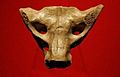
Sacrum bone found in Tequixquiac is considered a work of prehistoric art
-
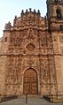
Tepotzotlán ex-convent
-
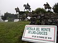
Monument to the Battle of Monte de las Cruces
-
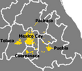
Spread of Greater Mexico City into Mexico and other states
-
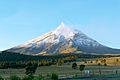
The Popocatépetl Volcano is the state's highest point
-
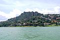
Lake Avandaro and Rock Principe at Bravo Valley
-
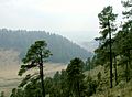
Forest at La Marquesa National Park
-

Ferrocarril Suburbano
-
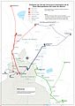
Projected map of the Tren Suburbano (only one line is currently available)
-
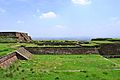
Serpent Square in Teotenango
-
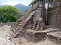
Malinalco ruins
-
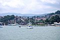
Bravo Valley panorama from Lake Avandaro
-
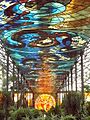
View of the interior of the Cosmovitral with the Sun Man in the background
-
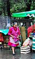
Mazahua woman, Mexico City. The Mazahuas are originating in the State of Mexico, and are a very common cliché about the indigenous peoples in Mexico City, due to the high migration that have toward beyond
-
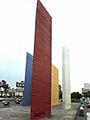
Torres de Satélite at Naucalpan, State of Mexico
-
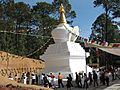
Tibetan stupa in Valle de Bravo. Maintained by the Casa Tibet México.


See also
 In Spanish: Estado de México para niños
