Naucalpan facts for kids
Quick facts for kids
Naucalpan de Juárez
|
|||
|---|---|---|---|
|
Municipality
|
|||
| Naucalpan de Juárez | |||
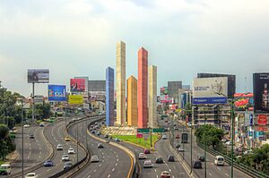
Torres de Satélite sculpture in Ciudad Satélite, a neighborhood in Naucalpan
|
|||
|
|||
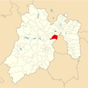
Location of Naucalpan in the State of Mexico
|
|||
| Country | |||
| State | |||
| Region | Naucalpan | ||
| Metro area | Greater Mexico City | ||
| Municipal Status | January 1, 1826 | ||
| Municipal Seat | Naucalpan de Juárez | ||
| Government | |||
| • Type | Ayuntamiento | ||
| Area | |||
| • Municipality | 156.63 km2 (60.48 sq mi) | ||
| • Water | 1.56 km2 (0.60 sq mi) | ||
| Elevation
(of seat)
|
2,300 m (7,500 ft) | ||
| Population
(2010 Census)
|
|||
| • Municipality | 833,779 | ||
| Time zone | UTC-6 (Central (US Central)) | ||
| • Summer (DST) | UTC-5 (Central) | ||
| Postal code (of seat) |
53000
|
||
| Area code(s) | 55 | ||
| Demonym | Naucalpense | ||
Naucalpan, officially called Naucalpan de Juárez, is a large area (a municipality) located just northwest of Mexico City. It's part of the State of Mexico. The main city in this area is also called Naucalpan de Juárez. Part of this city even stretches into the next-door municipality of Huixquilucan.
The name Naucalpan comes from the Nahuatl language. It means "place of the four neighborhoods" or "four houses." The name Juárez was added in 1874 to honor Benito Juárez, a famous Mexican president. The history of this area goes way back to the Tlatilca people, who lived here between 1700 and 600 BCE. Later, the Mexica people took over in the 1400s and gave it its current name.
Naucalpan is known for being a big industrial center in Mexico. It's also famous for Ciudad Satélite, a planned community built in the 1960s. Another well-known spot was the Toreo de Cuatro Caminos bullring, which was taken down to build a new shopping and office complex. Most of Naucalpan is now developed, with only a few green areas left like the Los Remedios National Park.
Contents
A Look at Naucalpan's Past
The Valley of Mexico, where Naucalpan is located, has been home to people for over 20,000 years! The story of Naucalpan started with the Tlatilca people. They settled near the Hondo River around 1700 to 600 BCE. Later, the Olmecs and then the Teotihuacan civilization influenced the Tlatilca.
Around 1000 to 1200 CE, the Chichimecas conquered the Tlatilca. They built the Pyramid del Conde, which you can still find in the El Conde neighborhood today. After that, the area was ruled by Tlacopan and became home to many Otomi people. Finally, in 1428, the Aztec Triple Alliance took control and gave the area the name Naucalpan.
The Spanish Arrive
On June 30, 1520, the Spanish leader Hernán Cortés and his men fled Tenochtitlan (now Mexico City). They were trying to escape the Aztecs. Legend says Cortés cried under a Montezuma Cypress tree, which some believe was in Naucalpan. This sad event is known as the "Noche Triste" or "Night of Sorrows."
Another story says that during their escape, a small statue of the Virgin Mary was left behind under a maguey plant. This is where the Sanctuary of Los Remedios stands today.
Colonial Times
In 1521, the Spanish took control of the area. Cortés gave the land to Isabel Moctezuma and Alonso de Grado, calling it San Bartholome Naucalpan. Franciscans (a group of priests) came to teach the native people about Christianity. They built churches like the Church of San Francisco de Assisi and the Church of Los Remedios. The Temple of San Bartolome Naucalpan was built in 1574.
During colonial times, Naucalpan was important for mining building materials like stone, sand, and gravel. These materials were used to build many famous buildings in Mexico City, including the Mexico City Metropolitan Cathedral.
Modern Naucalpan
In 1826, Naucalpan became an independent municipality. Industry started to grow here when the Hilados and Tejidos de Rio Hondo factory opened in 1869. Benito Juarez himself was there for the opening!
The Toreo de Cuatro Caminos, a famous bullring, opened in 1947. It was a symbol of the city for many years. However, it was torn down in 2009 to make way for a new shopping center.
Naucalpan officially became a city in 1957. In the same year, the building of Ciudad Satélite began. This big project was finished in 1963. Its five unique towers were designed by famous architects Luis Barragán and Matias Goeritz. By 1975, Naucalpan had become one of the most industrial cities in Mexico.
Life in Naucalpan Today
The city of Naucalpan is quite large. It even extends into the neighboring Huixquilucan Municipality. In 2010, the total population was over 913,000 people. Most of the people in Naucalpan Municipality live in the city itself. Only the Los Remedios National Park and a few farming areas (called ejidos) are not built up.
Naucalpan is a very important center for industry in Mexico. Many different products are made here, including food, drinks, clothes, wood items, and chemicals. There are several industrial parks, like Alce Blanco and Tlatilco.
Transportation and City Life
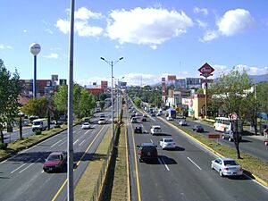
Many important roads go through Naucalpan. These roads connect the Mexico City area to other parts of the country. The northern part of the Anillo Periférico (a big ring road) goes through Ciudad Satélite. There are plans to make this road even bigger.
Naucalpan depends a lot on cars and other vehicles. There have been efforts to encourage biking, but they haven't been very successful yet.
Ciudad Satélite: A Modern Community
One of the most famous parts of Naucalpan is Ciudad Satélite, with its unique Torres de Satélite sculptures. This community was a big project started in the 1950s and 1960s. It was designed to be a suburban area with green spaces connecting it to Mexico City.
The Torres de Satélite were built by architects Luis Barragan and Matias Goeritz. These five colorful towers are shaped like prisms and are between 30 and 52 meters tall. They are located in a busy traffic circle and were meant to be a symbol of modern design and a "welcome" to the growing city. UNESCO has even recognized them as important architectural heritage!
Toreo de Cuatro Caminos
Another well-known landmark was the Toreo de Cuatro Caminos, a bullring built in the 1940s. It had a famous domed roof that became a symbol of the city. The area around it became a major transportation hub. The bullring was torn down in 2009 to build a large shopping and business complex called Toreo Parque Central. Even though the building is gone, its dome is still the symbol for the Metro Cuatro Caminos subway station.
Fun Places to Visit
Besides Ciudad Satélite and the new Toreo complex, Naucalpan has other interesting places:
- The Cerro Moctezuma, a mountain with historical importance.
- The Pyramid del Conde and Tlatilco, ancient sites.
- The Museum of Naucalpan, where you can learn about the area's history.
- Historic colonial buildings like the Aqueduct and the Bridge of Santa Cruz.
- Arena Naucalpan, a popular place for lucha libre (Mexican wrestling) shows.
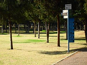
- Naucalli Park, a large green space with trees, bike paths, playgrounds, and a cultural center. The Symphony Band of Naucalpan often plays concerts here.
Learning in Naucalpan
Naucalpan has many schools and universities. Some of the well-known ones include:
- Colegio de Ciencias y Humanidades Plantel Naucalpan (a technical college)
- Universidad Nuevo Mundo
- Universidad del Valle de Mexico
- Several international schools like Colegio Alemán Alexander von Humboldt and Greengates School.
The Virgin of Los Remedios
The special protector of Naucalpan is the Virgin of Los Remedios. She is a small statue of the Virgin Mary, only about 27 cm tall. This statue is closely connected to the Spanish Conquest.
Legend says that one of Cortés’ soldiers hid the statue under a maguey plant during the "Night of Sorrows." Later, during a battle, the Spanish believed they saw a young girl helping them by throwing dirt into the eyes of the Aztecs. This statue is seen as a symbol for the Spanish and those who adopted Spanish ways.
Her special day is celebrated on September 1st. On this day, her sanctuary is decorated with white flowers. The sanctuary is located in the Los Remedios National Park, in the western part of the municipality. The celebration includes traditional dances like "Los Apaches" and "Los Moros."
Naucalpan's Natural Side
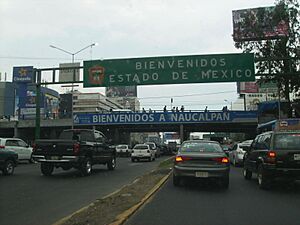
The Naucalpan Municipality covers about 150 square kilometers. It's located in the Valley of Mexico, next to Mexico City. It shares borders with several other municipalities and Mexico City itself.
The highest points in Naucalpan are the Organo and La Malinche mountains, which are about 3,650 meters high. The main rivers are the Totolina, San Lorenzo, and Los Remedios. Water for the municipality comes from deep wells and an aqueduct that brings water from the Lerma River.
Naucalpan has a mild climate with a rainy season in the summer. It can get cold between November and February, but heavy snow is rare. Outside the city, you can find pine and oak trees, as well as fruit trees like plums, apples, and pears. Small animals like squirrels and opossums live here. However, cutting down trees (deforestation) is a big problem.
Los Remedios National Park
The biggest natural area in Naucalpan is the Los Remedios National Park. It was created in 1938 and covers 400 hectares. Inside the park, you'll find the Sanctuary of the Virgin of Los Remedios, an old aqueduct from colonial times, and an ancient Chichimeca temple. These are all located around the Cerro Moctezuma mountain. This mountain was once an Aztec observatory.
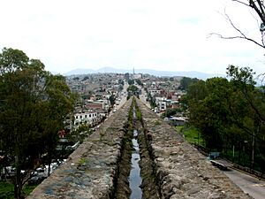
The aqueduct is about 500 meters long and has fifty arches, each about 16 meters high. It was built in 1616 to bring water to the Sanctuary of Los Remedios. This water was also used to water fields in nearby villages. The aqueduct is mostly made of clay pipes and has two large spiral towers that look like "snails."
Unfortunately, parts of the park now have illegal settlements. This means people are building homes where they shouldn't, which harms the natural environment and the historical sites.
Towns and Villages in Naucalpan
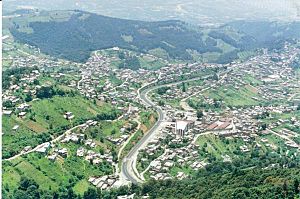
While Naucalpan de Juárez is the main city, the municipality also includes smaller towns and villages. Here are some of the largest ones:
| Name | 2010 Census Population |
|---|---|
| Naucalpan de Juárez | 792,211 |
| San Francisco Chimalpa | 8,953 |
| Ejido de San Francisco Chimalpa | 4,349 |
| Santiago Tepatlaxco | 3,864 |
| San José Tejamanil | 2,578 |
| Total Municipality | 833,779 |
Naucalpan's Economy
Naucalpan is one of the strongest economic areas in Mexico. Near Mexico City, there are many small and medium-sized businesses. These include places that make medicines, car parts, chemicals, and textiles (fabrics).
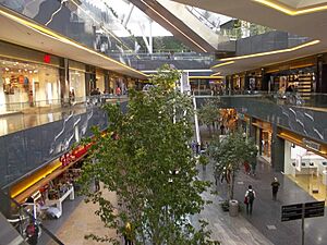
The shopping and services sector is also very important. It has grown a lot in the last 40 years, especially since the Plaza Satélite mall opened in 1971. Another big mall, La Cúspide Sky Mall, was built in 2007.
Studies show that Naucalpan creates a lot of wealth. In 2000, it produced enough wealth to cover its citizens' needs twice over! Naucalpan and its neighbor Ecatepec together are home to 19% of the State of Mexico's population and produce over 22% of the state's income.
Sister Cities
Naucalpan has special connections with other cities around the world. These are called "sister cities."
| City | State/Province | Country | Year |
|---|---|---|---|
| 1987 | |||
| Calgary | 1994 | ||
| Anyang | Gyeonggi | 1997 |
Climate
Naucalpan has a mild, temperate climate. This type of climate is found in elevated areas within tropical or subtropical regions. It's often called an "oceanic subtropical highland climate."
| Climate data for Naucalpan | |||||||||||||
|---|---|---|---|---|---|---|---|---|---|---|---|---|---|
| Month | Jan | Feb | Mar | Apr | May | Jun | Jul | Aug | Sep | Oct | Nov | Dec | Year |
| Mean daily maximum °C (°F) | 22 (72) |
24 (76) |
27 (80) |
27 (81) |
27 (81) |
26 (78) |
24 (75) |
24 (75) |
23 (74) |
23 (74) |
23 (74) |
22 (72) |
24 (76) |
| Mean daily minimum °C (°F) | 5 (41) |
6 (43) |
8 (47) |
11 (51) |
12 (53) |
13 (55) |
12 (53) |
12 (53) |
12 (53) |
10 (50) |
7 (45) |
6 (42) |
9 (49) |
| Average precipitation mm (inches) | 7.6 (0.3) |
7.6 (0.3) |
13 (0.5) |
25 (1) |
56 (2.2) |
150 (6.1) |
180 (7) |
170 (6.6) |
140 (5.7) |
64 (2.5) |
10 (0.4) |
5.1 (0.2) |
840 (32.9) |
| Source: Weatherbase | |||||||||||||
Education
Naucalpan is home to several schools and universities, including international schools.
International Schools
- Colegio Alemán Alexander von Humboldt Campus Norte
- Greengates School
- British American School
Other Schools
- Irish Institute (Instituto Irlandés)
- Escuela Sierra Nevada San Mateo Campus
- Colegio Cristóbal Colón
- Colegio Miraflores
- Academia Maddox
- Justo Sierra Plantel San Mateo
Colleges and Universities
- School of High Studies (FES) Acatlán, part of the National Autonomous University of Mexico
- College of Science and Humanities Naucalpan campus, also part of the National Autonomous University of Mexico
 | Delilah Pierce |
 | Gordon Parks |
 | Augusta Savage |
 | Charles Ethan Porter |


