Ecatepec de Morelos facts for kids
Quick facts for kids
Ecatepec de Morelos
Ecatepec
|
||
|---|---|---|
|
City & Municipality
|
||
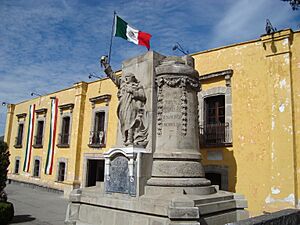
House of Morelos Museum
|
||
|
||
| Motto(s):
Autonomía, Unión, Trabajo (Autonomy, Union, Work)
|
||
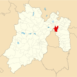
Location of Ecatepec in the State of Mexico
|
||
| Country | Mexico | |
| State | State of Mexico | |
| Metro area | Greater Mexico City | |
| Municipal Status | October 13, 1877 | |
| Municipal Seat | San Cristóbal Ecatepec | |
| Government | ||
| • Type | Ayuntamiento | |
| Area | ||
| • Total | 156.2 km2 (60.3 sq mi) | |
| • Water | 0.00 km2 (0 sq mi) | |
| Elevation
(of seat)
|
2,250 m (7,380 ft) | |
| Population
(2020)
|
||
| • Total | 1,645,352 | |
| • Rank | 9th in North America 3rd in Mexico |
|
| • Density | 10,533.6/km2 (27,282/sq mi) | |
| • Seat | 1,643,623 | |
| • Metro area | 21,804,515 | |
| Time zone | UTC−6 (CST) | |
| Postal code (of seat) |
55000
|
|
| Area code(s) | 55 | |
| Demonym | Ecatepequense | |
Ecatepec, officially known as Ecatepec de Morelos, is a very large city in the State of Mexico. It's located just north of the huge Greater Mexico City urban area. The main town in Ecatepec is called San Cristóbal Ecatepec.
Ecatepec is a giant city, with almost all of its 1.6 million people living within its city limits. It's the third most populated city in Mexico. It's also the biggest suburb of Greater Mexico City.
The name "Ecatepec" comes from the ancient Nahuatl language. It means "windy hill" or "hill for the wind god, Ehecatl". This name was also sometimes used for the god Quetzalcoatl. The "Morelos" part of the name honors José María Morelos, a brave hero from Mexico's fight for independence. The city's special saint is Saint Christopher, and people celebrate him on July 25.
Getting around Ecatepec is easy! It has its own metro stations. There are also special bus lines called Mexibús. Plus, you can ride cool cable car lines that float above the city.
Some interesting places to visit include the Sacred Heart of Jesus Cathedral. You can also see several old churches from colonial times. Don't miss the Morelos Museum, which is in a building called "Casa de los Virreyes." Ecatepec is also home to one of Mexico's busiest shopping centers, Multiplaza Aragón.
Contents
Geography of Ecatepec
The municipality of Ecatepec is located north of Mexico City. San Cristóbal Ecatepec is the main town. It oversees other communities like San Pedro Xoloxtoc and Ciudad Azteca.
The area of Ecatepec is about 156 square kilometers (60 square miles). It shares borders with several other municipalities. These include Tlalnepantla de Baz, Tecámac, and Nezahualcóyotl. It also borders a part of Mexico City called Gustavo A. Madero.
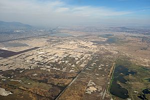
The city of Ecatepec de Morelos is built in a long valley. This valley stretches from the Valley of Mexico to the Sierra de Guadalupe mountains.
Plants and Animals in Ecatepec
Most of the local plants and animals live in the Sierra de Guadalupe mountains. You can find small mammals there. These include mice, rabbits, gray squirrels, and gophers. There are also birds like mockingbirds and sparrows. You won't find any large animals in the area. The plants include different types of pine trees, oaks, and ocote pines. You can also see century plants, prickly pears, and mountain grass called zacatón.
History of Ecatepec
Ancient Aztec Times
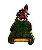
Scientists have found signs of the earliest people living in this area. These signs were found on a nearby hill called Cerro de Ecatepec. The area was first settled by groups of Otomi people. Later, other groups like the Toltecs and Chichimecas arrived. They took control of the rest of the Valley of Mexico. Eventually, the powerful Aztec Empire came to rule this area. Ecatepec was an Aztec altepetl, which means it was like a city-state in the Valley of Mexico.
From 1428 to 1539, Ecatepec was led by a ruler called a tlatoani. The tlatoani of Ecatepec were often related to the royal family of Tenochtitlan. Tenochtitlan was the capital of the Aztec Empire. Some important tlatoani included:
- Chimalpilli I, who was the grandson of Moctezuma I.
- Tezozomoc, the son of Chimalpopoca.
- Matlaccohuatl, whose daughter Teotlalco married Moctezuma II.
- Chimalpilli II, the son of Ahuitzotl.
- Diego de Alvarado Huanitzin, who was the grandson of Axayacatl.
Diego Huanitzin was later made the tlatoani of Tenochtitlan. This was done by Antonio de Mendoza, who was the first viceroy of New Spain. A viceroy was a ruler who represented the king of Spain.
During the time of the Aztec Triple Alliance (the Aztec Empire), the Mexica people used Ecatepec. They used the town to control important trade routes that went north.
Spanish Rule and Independence
In 1560, Ecatepec was given a special status called a "República de Indios" (Indian Republic). This allowed the village to keep some control over its own affairs. It also allowed them to continue having their own tlatoani leaders. However, in the early 1600s, this changed. The Spanish took over the administration. They combined Ecatepec with other communities like Zumpango.
A famous Mexican hero, José María Morelos y Pavón, was executed in Ecatepec in 1815. This happened during the Mexican War of Independence, when Mexico was fighting for freedom from Spain. The house where he was executed is now a museum called Museo Casa de Morelos.
The municipality of Ecatepec was officially created on October 13, 1874. A few years later, on October 1, 1877, San Cristóbal Ecatepec was declared a village. The name "de Morelos" was added to its name to honor the hero.
Modern Ecatepec
Ecatepec grew very quickly starting in 1970. Many people moved there from rural areas to the Valley of Mexico. San Cristóbal Ecatepec was officially declared a city on December 1, 1980. By 2010, it had become the most populated municipality in all of Mexico! However, its population growth has slowed down since then.
The Roman Catholic Diocese of Ecatepec is one of the newest in the country. It was created on June 28, 1995. Its main church is the Sagrado Corazón de Jesús Cathedral.
In April 1995, the bones of a mammoth were found in a neighborhood called Colonia Ejidos de San Cristóbal. This area was where two ancient lakes, Xaltocan-Ecatepec and Texcoco, met. The Aztecs had even built a dam there to keep the fresh and salty waters separate. The mammoth bones are thought to be about 10,500 years old!
In February 2016, Pope Francis visited Ecatepec. He held a special Mass for about 300,000 people. The Pope's message was about hope and standing against violence in the region.
Population of Ecatepec
Almost all of the people (99.934%) in the municipality live in San Cristóbal Ecatepec. This makes it the third most populated city in Mexico. There are also three small rural communities in the municipality.
| Community | 2020 Census Population |
|---|---|
| San Cristóbal Ecatepec | 1,643,623 |
| Mesa de los Leones | 1,043 |
| Tierra Blanca 2a Sección (Ejido Ecatepec) | 615 |
| Vista Hermosa | 71 |
| Total Municipality | 1,645,352 |
Economy of Ecatepec
Ecatepec is an important industrial center. Making things in factories, along with shops and services, are the main parts of the city's economy.
The famous juice company Jumex has its main office in Ecatepec.
Two large shopping malls, Plaza Las Américas and Multiplaza Aragón, are also located here. Multiplaza Aragón was even Mexico's busiest shopping center in 2018! Both malls have many big stores and department stores.
Transportation in Ecatepec
Because so many people live in Ecatepec, it has a lot of transportation options.
Major Roads
Ecatepec is an important pathway from Mexico City to other states like Hidalgo. Here are some of its main roads:
- Vía Morelos: This road passes through important industrial areas. Many factories, including Jumex and La Costeña, are located along this road.
- Avenida Nacional: This road connects with other highways and continues to the border with Tecámac.
- Avenida Central: This busy road crosses many neighborhoods in Ecatepec. Line B of the Mexico City Metro and the first line of Mexibús run along this avenue.
- Autopista México-Pachuca: This highway starts in Mexico City and has exits in San Cristóbal Ecatepec. It also has a branch that leads to the ancient Teotihuacan pyramids.
- Avenida 30-30 (or Avenida Revolución): This avenue is in the San Cristóbal area. It's famous for its "explanada 30-30" where many bands have performed.
- Autopista Circuito Exterior Mexiquense: This highway helps drivers avoid traffic on Avenida Central, especially during busy times.
Public Transport Options
Ecatepec is served by Line B of the Mexico City Metro system. Its stations include Muzquiz, Ecatepec, Olímpica, Plaza Aragón, and Ciudad Azteca.
The Mexibús bus rapid transit system also serves Ecatepec with several lines:
- Line I goes from Ciudad Azteca to Ojo de Agua and even to the Felipe Ángeles International Airport.
- Line II connects Las Américas to La Quebrada.
- Line IV runs from Indios Verdes to Universidad Mexiquense del Bicentenario in Tecamac.
In 2016, a new type of public transport started in Ecatepec: Mexicable. This is an aerial cable car system. It's designed to help people get around faster, especially in hilly areas. Mexicable Line 1 is almost 5 kilometers (3 miles) long. It has 190 cars and takes about 17 minutes to ride the whole line. Line 1 connects Santa Clara with La Cañada. At Hank González station, Mexicable Line 2 connects to Indios Verdes. This is a major hub for many types of public transport.
Ecatepec is also located on important federal highways. These include Mexican Federal Highway 85 (the Mexico City-Pachuca highway), Mexican Federal Highway 57 (Circuito Exterior Mexiquense), and Mexican Federal Highway 132 (the Ecatepec-Teotihuacán highway).
Sister Cities
Ecatepec has "sister city" relationships with several cities around the world. This means they share cultural and economic ties.
| City | State | Country |
|---|---|---|
| Caracas | Miranda | |
| Cuautla | ||
| Guadalupe | ||
| Guangzhou | Guangdong | |
| Namyangju | Gyeonggi-do | |
| San Jose | San Jose Province | |
| Guarulhos | São Paulo |
 | Frances Mary Albrier |
 | Whitney Young |
 | Muhammad Ali |


