Atlas, Pennsylvania facts for kids
Quick facts for kids
Atlas, Pennsylvania
|
|
|---|---|

Atlas, Pennsylvania
|
|
| Country | United States |
| State | Pennsylvania |
| County | Northumberland |
| Area | |
| • Total | 0.27 sq mi (0.70 km2) |
| • Land | 0.27 sq mi (0.70 km2) |
| • Water | 0.00 sq mi (0.00 km2) |
| Population
(2020)
|
|
| • Total | 732 |
| • Density | 2,721.19/sq mi (1,052.09/km2) |
| Time zone | UTC-5 (Eastern (EST)) |
| • Summer (DST) | UTC-4 (EDT) |
| ZIP code |
17851
|
| Area code(s) | 272 and 570 |
| FIPS code | 42-03464 |
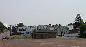
Atlas is a small community in Pennsylvania, United States. It's known as a census-designated place (CDP). This means it's an area that looks like a town but doesn't have its own local government. It's located in Mount Carmel Township, within Northumberland County.
Atlas is very close to the larger town of Mount Carmel. You can find it right along Pennsylvania Route 61.
About Atlas
Atlas is a quiet place with a small population. It covers a land area of about 0.70 square kilometers (0.27 square miles).
Population Changes
The number of people living in Atlas has changed over the years.
- In 2010, there were 809 residents.
- By the 2020 census, the population was 732 people.
This shows a slight decrease in the number of residents over that decade.
Location and Geography
Atlas is situated in the eastern part of Pennsylvania. It's part of a region known for its history, especially related to coal mining.
Nearby Areas
Being close to Mount Carmel, residents of Atlas can easily access services and shops in the larger borough. The area is connected by important roads like Pennsylvania Route 61.
See also
In Spanish: Atlas (Estados Unidos) para niños
 | Claudette Colvin |
 | Myrlie Evers-Williams |
 | Alberta Odell Jones |

