Avery, Iowa facts for kids
Quick facts for kids
Avery, Iowa
|
|
|---|---|
| Country | |
| State | |
| County | Monroe County |
| Elevation | 276 m (906 ft) |
| Time zone | UTC-6 (Central (CST)) |
| • Summer (DST) | UTC-5 (CDT) |
| GNIS feature ID | 454289 |
Avery is a small, unincorporated community in Monroe County, Iowa, United States. An unincorporated community means it's a group of homes or businesses that isn't officially a town or city with its own local government.
Contents
Where is Avery Located?
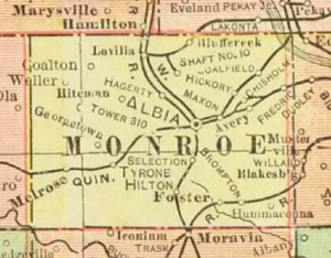
Avery is found in the state of Iowa. It's located about 6 miles (10 km) northeast of a town called Albia. You can find it where two roads meet: County Road H27 and 700th Avenue.
The Story of Avery
How Avery Began
Avery was started in 1868. This was the year the Chicago, Burlington and Quincy Railroad built its tracks through this area. Railroads were very important back then. They helped new communities grow.
What's in a Name?
When Avery was first founded, it had a different name. It was called Coffman. This name came from the person who owned the land where the community was built. Later, the name was changed to Avery. This new name was inspired by a nearby stream called Avery Creek.
Population Over Time
In 1940, Avery had a population of 300 people. This gives us an idea of its size in the past.
 | Janet Taylor Pickett |
 | Synthia Saint James |
 | Howardena Pindell |
 | Faith Ringgold |


