Bala, Kansas facts for kids
Quick facts for kids
Bala, Kansas
|
|
|---|---|

|
|
| Country | United States |
| State | Kansas |
| Counties | Riley |
| Founded | 1862 |
| Named for | Bala |
| Elevation | 1,293 ft (394 m) |
| Population
(2020)
|
|
| • Total | 29 |
| Time zone | UTC-6 (CST) |
| • Summer (DST) | UTC-5 (CDT) |
| Area code | 785 |
| FIPS code | 20-03800 |
| GNIS ID | 2804655 |
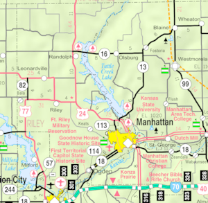
Bala is a small community located in Riley County, Kansas, in the United States. It is known as a census-designated place (CDP). This means it's an area that the U.S. Census Bureau identifies for gathering statistics. In 2020, the population of Bala was 29 people.
History
Bala was settled around the year 1862. It became an important spot for moving goods because it was a shipping point on the Chicago, Rock Island and Pacific Railroad line. The community got its name from a town called Bala in Wales.
A post office was opened in Bala in 1871. It served the local community for many years. The post office eventually closed down in 1966.
Education
Students in Bala are part of the Riley County USD 378 public school district. This district provides education for the community's young people.
 | Selma Burke |
 | Pauline Powell Burns |
 | Frederick J. Brown |
 | Robert Blackburn |


