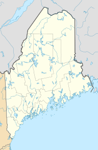
Beddington Lake facts for kids
Quick facts for kids Beddington Lake |
|
|---|---|
| Location | Washington County, Maine, United States |
| Coordinates | 44°49′N 68°03′W / 44.82°N 68.05°W |
| Lake type | Glacial |
| Primary inflows | Narraguagus River |
| Primary outflows | Narraguagus River |
| Basin countries | United States |
| Max. length | 2.2 mi (3.5 km) |
| Max. width | 0.6 mi (0.97 km) |
| Surface area | 404 acres (163 ha) |
| Average depth | 19 ft (5.8 m) |
| Max. depth | 59 ft (18 m) |
| Water volume | 7,119 acre-foot (8,781,000 m3) |
| Shore length1 | 11.4 mi (18.3 km) |
| Surface elevation | 243 ft (74 m) |
| Islands | 5+ |
| 1 Shore length is not a well-defined measure. | |
Beddington Lake is a beautiful lake found in Washington County, Maine, in the United States. It's a calm and natural place, located very close to the border of Hancock County. You can find it near the small town of Beddington, where two main roads, Maine State Routes 9 and 193, meet.
Contents
Where is Beddington Lake Located?
Beddington Lake is nestled in the eastern part of Maine. It's in Washington County, which is known for its beautiful forests and many lakes. The lake is quite close to the town of Beddington. This area is often quiet and peaceful, perfect for enjoying nature.
How Big is Beddington Lake?
Beddington Lake is a good-sized lake. It stretches about 2.2 miles (3.5 km) long. At its widest point, the lake is about 0.6 miles (0.97 km) across. The total area of the lake covers about 404 acres (163 ha). That's a lot of water!
Lake Depth and Shoreline
The average depth of Beddington Lake is around 19 feet (5.8 m). However, in some spots, it can get much deeper, reaching a maximum depth of about 59 feet (18 m). The shoreline of the lake, which is the edge where the land meets the water, is about 11.4 miles (18.3 km) long. This long shoreline means there are many interesting places to explore around the lake.
How Was Beddington Lake Formed?
Beddington Lake is a type of lake called a glacial lake. This means it was formed thousands of years ago by huge sheets of ice called glaciers. As these giant glaciers moved across the land, they carved out valleys and depressions. When the glaciers melted, these depressions filled with water, creating lakes like Beddington Lake. This process happened a very long time ago, shaping the landscape we see today.
Water Flow: In and Out
The main river that flows into Beddington Lake is the Narraguagus River. This river also flows out of the lake, continuing its journey. This means the Narraguagus River is very important to the lake's water supply and how its water moves. The lake also has more than five small islands within it, adding to its natural beauty.
What's Around the Lake?
The area around Beddington Lake is mostly natural and undeveloped. There are several unpaved roads that lead to different parts of the lake. You'll also find some private homes and cabins along the shore. It's a place where people can enjoy the quiet outdoors and the beauty of the Maine wilderness.
 | Madam C. J. Walker |
 | Janet Emerson Bashen |
 | Annie Turnbo Malone |
 | Maggie L. Walker |


