Belvidere, Kansas facts for kids
Quick facts for kids
Belvidere, Kansas
|
|
|---|---|

|
|
| Country | United States |
| State | Kansas |
| County | Kiowa |
| Founded | 1880s |
| Elevation | 1,841 ft (561 m) |
| Time zone | UTC-6 (CST) |
| • Summer (DST) | UTC-5 (CDT) |
| Area code | 620 |
| FIPS code | 20-05875 |
| GNIS ID | 470715 |
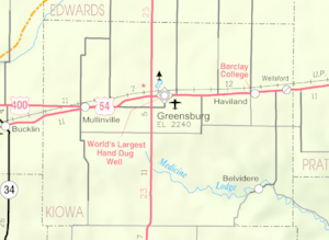
Belvidere is a small, unincorporated community in Kiowa County, Kansas, United States. An unincorporated community means it's a place with a shared identity but no local government of its own. This community is located right along the Medicine Lodge River.
History of Belvidere
Belvidere began as an important spot for sending goods. It was a "shipping point" on the Atchison, Topeka and Santa Fe Railway. This means trains would stop here to pick up or drop off items.
Post Office Changes
For a while, the community had a post office named Glick. It opened in 1883 and operated until 1890. On April 26, 1890, the Glick post office changed its name to Belvidere. The Belvidere post office served the community for many years. It finally closed down on November 23, 1996.
Ancient Rock Art Sites
Close to Belvidere, you can find two interesting historical places. These are the Roth Petroglyph Site and the Star Petroglyph Site. A petroglyph is a very old drawing or carving made on a rock. Both of these sites are listed on the National Register of Historic Places. This means they are important places that are worth protecting.
Weather Radio Station
In the mid-2000s, Belvidere became home to a special weather radio transmitter. This transmitter is called WNG534. It is part of the NOAA Weather Radio system. This system broadcasts important weather alerts and information. The transmitter is operated by the National Weather Service Forecast Office. This office is located in nearby Dodge City.
 | Frances Mary Albrier |
 | Whitney Young |
 | Muhammad Ali |


