Medicine Lodge River facts for kids
Quick facts for kids Medicine Lodge River |
|
|---|---|

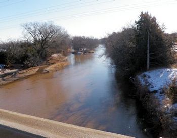
Medicine Lodge River near Kiowa
|
|

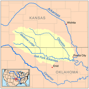
Map of the Salt Fork Arkansas watershed including the Medicine Lodge River
|
|
| Other name(s) | A-ya-dalda-pa River, Hohkii'yohe, Medicine River |
| Country | United States |
| State | Kansas, Oklahoma |
| Physical characteristics | |
| Main source | Kiowa County, Kansas 2,330 ft (710 m) 37°30′51″N 99°20′22″W / 37.51417°N 99.33944°W |
| River mouth | Salt Fork Arkansas River Alfalfa County, Oklahoma 1,165 ft (355 m) 36°49′40″N 98°19′38″W / 36.82778°N 98.32722°W |
| Length | 130 mi (210 km) |
| Basin features | |
| Watersheds | Medicine Lodge-Salt Fork Arkansas-Arkansas- Mississippi |
The Medicine Lodge River is a river in the southern part of Kansas and northern Oklahoma in the United States. It is about 130-mile-long (210 km). The Medicine Lodge River is a smaller river that flows into the Salt Fork of the Arkansas River. From there, its water eventually joins the Arkansas and then the mighty Mississippi River. This means it is part of the huge area of land, called a watershed, where all the water flows into the Mississippi River.
River's Name and History
The Medicine Lodge River got its name from the Kiowa Native American people. They built a large hut near the river. The Kiowa believed that the river's water had special healing powers. They thought it could help people feel better if they drank it or breathed its steam in a special room, like a sauna.
In 1968, a group called the United States Board on Geographic Names officially decided to call the river "Medicine Lodge River." But over time, it has also been known by other names. Some of these names include "A-ya-dalda-pa River," "Medicine Lodge Creek," and simply "Medicine River."
Where the River Flows
The Medicine Lodge River starts in Kiowa County, Kansas. From there, it generally flows towards the southeast. It travels through Barber County in Kansas. Along its path, it passes by the Kansas towns of Belvidere, Sun City, and Medicine Lodge.
The river then continues its journey into Alfalfa County in Oklahoma. Finally, it joins the Salt Fork of the Arkansas River. This meeting point is about 5 miles (8 km) north-northeast of the town of Cherokee in Oklahoma.
 | Tommie Smith |
 | Simone Manuel |
 | Shani Davis |
 | Simone Biles |
 | Alice Coachman |

