Medicine Lodge, Kansas facts for kids
Quick facts for kids
Medicine Lodge, Kansas
|
|
|---|---|
|
City and County seat
|
|

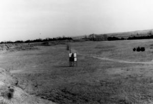
Natural amphitheater at the Medicine Lodge Peace Treaty Site (1969)
|
|

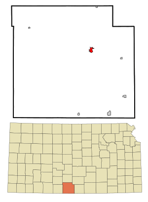
Location within Barber County and Kansas
|
|

|
|
| Country | United States |
| State | Kansas |
| County | Barber |
| Founded | 1873 |
| Incorporated | 1879 |
| Named for | medicine lodge |
| Area | |
| • Total | 1.20 sq mi (3.10 km2) |
| • Land | 1.20 sq mi (3.10 km2) |
| • Water | 0.00 sq mi (0.00 km2) |
| Elevation | 1,483 ft (452 m) |
| Population
(2020)
|
|
| • Total | 1,781 |
| • Density | 1,484/sq mi (574.5/km2) |
| Time zone | UTC-6 (CST) |
| • Summer (DST) | UTC-5 (CDT) |
| ZIP code |
67104
|
| Area code | 620 |
| FIPS code | 20-45500 |
| GNIS ID | 2395083 |
Medicine Lodge is a city in Kansas, United States. It is also the county seat of Barber County. This means it is the main city where the county government is located. In 2020, about 1,781 people lived here.
Contents
History of Medicine Lodge
Early History and the Medicine Lodge River
The name Medicine Lodge comes from a special shelter. This shelter was made of tree trunks and branches. The Kiowa people built it for their yearly sun dance in 1866. This happened in the valley of the Medicine Lodge River. The Kiowa called the river "A-ya-dalda P’a," meaning "Timber-hill River." They thought the area was sacred because the river had a lot of Epsom salts.
The Peace Treaty of 1867
In October 1867, an important event took place. Three treaties were signed here. These treaties were between the United States and several Native American groups. These groups included the Kiowa, Comanche, Plains Apache, Southern Cheyenne, and Southern Arapaho. This event is known as the Medicine Lodge Treaty.
Today, a special show called the Peace Treaty Pageant remembers this event. It started in 1927 and happens every three years. It takes place in an outdoor theater.
Founding and Growth of the Town
Settlers started the town of Medicine Lodge in February 1873. It was founded by a man named John Hutchinson. The town quickly grew. Within a year, it had a hotel, stores, and a post office.
In 1874, people in the town built a stockade. This was a strong fence made of logs. It was built to protect against Native raids. Some settlers were killed nearby, but the stockade itself was not attacked. Medicine Lodge officially became a city in 1879.
Carrie Nation and Temperance
Carrie Nation was a famous activist who lived in Medicine Lodge. She started her fight against alcohol sales here in 1900. She was part of the temperance movement. You can visit her home and a copy of the 1873 stockade today.
Geography and Climate
Where Medicine Lodge is Located
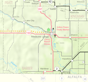
Medicine Lodge is in south-central Kansas. It is in an area called the Red Hills. The city is just north of where the Medicine Lodge River and Elm Creek meet. Elm Creek flows around the city's east and south sides. A small stream that flows through Medicine Lodge has a dam on it. This dam forms a reservoir called Barber County State Lake.
The city is also located where two major roads cross. These are U.S. Routes 160 and 281. The city covers about 1.21 square miles (3.13 square kilometers) of land.
Weather in Medicine Lodge
Medicine Lodge has a humid subtropical climate. This means it has hot, humid summers. Winters are cold and dry. The hottest temperature ever recorded was 118°F (48°C) in August 1936. The coldest was -22°F (-30°C) in February 1905.
| Climate data for Medicine Lodge, Kansas, 1991–2020 normals, extremes 1895–present | |||||||||||||
|---|---|---|---|---|---|---|---|---|---|---|---|---|---|
| Month | Jan | Feb | Mar | Apr | May | Jun | Jul | Aug | Sep | Oct | Nov | Dec | Year |
| Record high °F (°C) | 82 (28) |
91 (33) |
98 (37) |
100 (38) |
106 (41) |
113 (45) |
115 (46) |
118 (48) |
112 (44) |
100 (38) |
90 (32) |
85 (29) |
118 (48) |
| Mean maximum °F (°C) | 69.1 (20.6) |
74.3 (23.5) |
83.0 (28.3) |
89.8 (32.1) |
94.7 (34.8) |
100.3 (37.9) |
104.9 (40.5) |
103.5 (39.7) |
98.1 (36.7) |
90.0 (32.2) |
79.2 (26.2) |
67.7 (19.8) |
106.3 (41.3) |
| Mean daily maximum °F (°C) | 46.2 (7.9) |
50.4 (10.2) |
60.2 (15.7) |
70.0 (21.1) |
79.3 (26.3) |
90.1 (32.3) |
94.4 (34.7) |
92.4 (33.6) |
84.4 (29.1) |
71.8 (22.1) |
58.3 (14.6) |
47.0 (8.3) |
70.4 (21.3) |
| Daily mean °F (°C) | 34.1 (1.2) |
38.0 (3.3) |
47.5 (8.6) |
56.9 (13.8) |
67.0 (19.4) |
77.6 (25.3) |
82.0 (27.8) |
80.0 (26.7) |
71.7 (22.1) |
58.5 (14.7) |
45.6 (7.6) |
35.5 (1.9) |
57.9 (14.4) |
| Mean daily minimum °F (°C) | 22.0 (−5.6) |
25.6 (−3.6) |
34.7 (1.5) |
43.8 (6.6) |
54.6 (12.6) |
65.0 (18.3) |
69.5 (20.8) |
67.6 (19.8) |
59.1 (15.1) |
45.2 (7.3) |
32.9 (0.5) |
24.0 (−4.4) |
45.3 (7.4) |
| Mean minimum °F (°C) | 5.1 (−14.9) |
7.8 (−13.4) |
16.0 (−8.9) |
26.4 (−3.1) |
37.9 (3.3) |
52.3 (11.3) |
59.2 (15.1) |
57.1 (13.9) |
41.8 (5.4) |
27.2 (−2.7) |
15.5 (−9.2) |
7.2 (−13.8) |
0.6 (−17.4) |
| Record low °F (°C) | −20 (−29) |
−22 (−30) |
−7 (−22) |
14 (−10) |
22 (−6) |
39 (4) |
47 (8) |
40 (4) |
29 (−2) |
9 (−13) |
0 (−18) |
−18 (−28) |
−22 (−30) |
| Average precipitation inches (mm) | 0.80 (20) |
1.03 (26) |
2.03 (52) |
2.43 (62) |
3.65 (93) |
3.93 (100) |
3.13 (80) |
3.51 (89) |
2.61 (66) |
2.44 (62) |
1.10 (28) |
1.09 (28) |
27.75 (706) |
| Average snowfall inches (cm) | 2.1 (5.3) |
4.0 (10) |
0.8 (2.0) |
0.1 (0.25) |
0.0 (0.0) |
0.0 (0.0) |
0.0 (0.0) |
0.0 (0.0) |
0.0 (0.0) |
0.0 (0.0) |
0.3 (0.76) |
2.1 (5.3) |
9.4 (23.61) |
| Average precipitation days (≥ 0.01 in) | 4.3 | 5.6 | 6.8 | 8.2 | 9.0 | 8.7 | 6.7 | 8.6 | 5.8 | 7.2 | 4.4 | 4.8 | 80.1 |
| Average snowy days (≥ 0.1 in) | 1.2 | 1.4 | 0.4 | 0.0 | 0.0 | 0.0 | 0.0 | 0.0 | 0.0 | 0.0 | 0.3 | 1.5 | 4.8 |
| Source: NOAA | |||||||||||||
People of Medicine Lodge
| Historical population | |||
|---|---|---|---|
| Census | Pop. | %± | |
| 1880 | 373 | — | |
| 1890 | 1,095 | 193.6% | |
| 1900 | 917 | −16.3% | |
| 1910 | 1,229 | 34.0% | |
| 1920 | 1,305 | 6.2% | |
| 1930 | 1,655 | 26.8% | |
| 1940 | 1,870 | 13.0% | |
| 1950 | 2,288 | 22.4% | |
| 1960 | 3,072 | 34.3% | |
| 1970 | 2,545 | −17.2% | |
| 1980 | 2,384 | −6.3% | |
| 1990 | 2,453 | 2.9% | |
| 2000 | 2,193 | −10.6% | |
| 2010 | 2,009 | −8.4% | |
| 2020 | 1,781 | −11.3% | |
| U.S. Decennial Census | |||
Population in 2020
The 2020 United States census counted 1,781 people in Medicine Lodge. There were 806 households, which are groups of people living together. About 459 of these were families. The city had about 1,487 people per square mile.
Most people in Medicine Lodge were white (about 89.7%). There were also small numbers of black, Native American, and Asian people. About 5.7% of the population was Hispanic or Latino.
About 26% of households had children under 18. Many households (43.2%) were married couples. About 40% of households had only one person living there. The average age in the city was 41 years old.
Population in 2010
In the census of 2010, there were 2,009 people living in Medicine Lodge. There were 876 households. The city's population density was about 1,660 people per square mile.
Most people were White (96.3%). About 2.4% of the people were Hispanic or Latino.
About 29.5% of households had children under 18. The average age in the city was 40 years.
Economy and Education
Local Businesses
- National Gypsum is a company that has operations in Medicine Lodge.
Schools in Medicine Lodge
The Barber County North USD 254 school district serves Medicine Lodge. It provides public education from pre-kindergarten through high school. There are two schools in the city:
- Medicine Lodge Grade School (for Grades Pre-K to 6)
- Medicine Lodge Junior-Senior High School (for Grades 7 to 12)
Transportation and Media
Getting Around Medicine Lodge
Two main U.S. Routes, U.S. Route 281 (north-south) and U.S. Route 160 (east-west), meet in the city.
The Medicine Lodge Airport is about 1.5 miles (2.4 km) southeast of the city. It is used for general aviation, which means smaller, private planes.
The V&S Railway has a rail line that runs through the southwestern part of the city. Medicine Lodge is the end point for this rail line.
News and Radio
Newspapers
- The Gyp Hill Premiere is a weekly newspaper.
Radio Stations Medicine Lodge has two radio stations:
| Frequency | Callsign | Type of Music | Notes |
|---|---|---|---|
| 91.5 | KSNS | Contemporary Christian | - |
| 101.7 | KREJ | Christian | - |
Culture and Attractions
The Peace Treaty Pageant
Every three years, Medicine Lodge hosts a special pageant. This show celebrates the 1867 Medicine Lodge Treaty. The city first held this pageant in 1927. It has been held every three years since 1961.
Places to Visit
- Carrie Nation House: The home of the famous temperance activist.
- Stockade House: A reproduction of the old wooden fort.
- Peace Treaty Statue: Located on North Main Street.
- Wisner Fountain: An old fountain on North Main Street, once used to water horses.
- Kansas Historical Marker - Medicine Lodge Peace Treaties: A sign located 1 mile east of Medicine Lodge that tells about the treaties.
Notable People from Medicine Lodge
- Carleton Beals (1893–1979), a journalist and author.
- B. H. Born (1932–2013), a famous basketball player.
- Dorothy DeLay (1917–2002), a well-known violin teacher.
- Edward Hunkeler (1894–1970), a Roman Catholic Archbishop.
- Chester Long (1860–1934), a U.S. Representative and U.S. Senator from Kansas.
- Carrie Nation (1846–1911), a strong supporter of the temperance movement.
- Jerry Simpson (1842–1905), a U.S. Representative from Kansas.
- Jasper Tincher (1878–1951), a U.S. Representative from Kansas.
See also
 In Spanish: Medicine Lodge para niños
 | William L. Dawson |
 | W. E. B. Du Bois |
 | Harry Belafonte |

