Black Meldon facts for kids

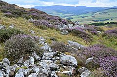
Remains of the boundary wall of the fort
|
|
| Location | Near Lyne, Scotland |
|---|---|
| Coordinates | 55°40′10″N 3°15′48″W / 55.66944°N 3.26333°W |
| Altitude | 407 m (1,335 ft) |
| Type | Hillfort |
| History | |
| Periods | Iron Age |
| Reference no. | SM2703 |
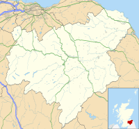
Black Meldon is an ancient site in Scotland. It is a type of old fort called a hillfort. You can find it near the village of Lyne. This spot is about 4 miles (6.4 km) west of Peebles in the Scottish Borders area. Black Meldon is protected as a Scheduled Monument. This means it is an important historical place.
Another hillfort, called White Meldon, is nearby. It is about 1 mile (1.6 km) to the east. A small stream called Meldon Burn runs between the two hills.
What is Black Meldon?
Black Meldon is a hill that stands 407 meters (1,335 feet) high. The top of the hill has a gentle slope on its west side. The other sides of the hill are much steeper. This made it a good place to build a fort for protection.
The Fort's Design
The fort itself is on the very top of the hill. It is shaped like a rough oval. It measures about 73 meters (240 feet) from north to south. It is about 40 meters (130 feet) from west to east.
The fort was surrounded by a strong boundary wall. Today, this wall looks like a wide band of stones and earth. It is about 3 meters (10 feet) wide. There are also signs of an outer wall on the north, west, and south sides. These walls would have made the fort very hard to attack.
Life Inside the Fort
Archaeologists have found clues about life inside Black Meldon. They have found at least three flat areas. These are called house-platforms. They show where ancient homes once stood. People lived here during the Iron Age. This was a time when people used iron tools and weapons. They built strong forts like Black Meldon to protect their communities.


