Bledsoe, Texas facts for kids
Quick facts for kids
Bledsoe, Texas
|
|
|---|---|
| Country | United States |
| State | Texas |
| County | Cochran |
| Population
(1990 est.)
|
|
| • Total | 125 |
| Time zone | UTC-6 (Central (CST)) |
| • Summer (DST) | UTC-5 (CDT) |
| ZIP codes |
79314
|
| Area code(s) | 806 |
| FIPS code | 48-08644 |
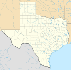
Bledsoe is a small community in western Texas, United States. It is located in Cochran County, very close to the New Mexico border. It's about 68 miles west of a bigger city called Lubbock. In 1990, about 125 people lived there.
History of Bledsoe
Bledsoe was started in 1925. It was the end point for the Panhandle and Santa Fe Railway line. The town was named after Samuel T. Bledsoe, who was the president of that railway.
Bledsoe became important because it was a place where cattle could be shipped. This helped the town grow. In 1930, Bledsoe reached its largest population of 400 people.
However, the Great Depression in the 1930s greatly affected the community. After that, the number of people living in Bledsoe slowly went down. By 1990, the population was 125. In 2020, it was 56 people.
Education in Bledsoe
Students in Bledsoe attend school within the Whiteface Consolidated Independent School District. This school district serves several communities in the area.
Before 1996, Bledsoe had its own school district. But on July 1, 1996, the Bledsoe Independent School District joined with the Whiteface CISD.
Population Changes
The number of people living in Bledsoe has changed over the years.
| Historical population | |||
|---|---|---|---|
| Census | Pop. | %± | |
| 2020 | 56 | — | |
| U.S. Decennial Census 1850–1900 1910 1920 1930 1940 1950 1960 1970 1980 1990 2000 2010 |
|||
Bledsoe was first officially counted as a "census designated place" in the 2020 U.S. Census. This means it was recognized as a specific area for population counting.
 | Delilah Pierce |
 | Gordon Parks |
 | Augusta Savage |
 | Charles Ethan Porter |


