Bollons Island facts for kids

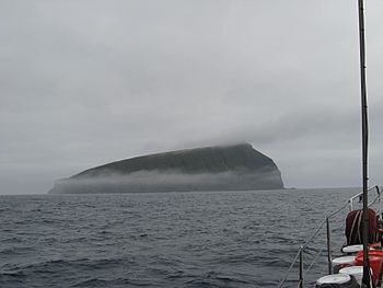
Bollons Island, as seen from near Antipodes Island
|
|

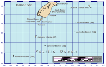
Position relative to New Zealand and other outlying islands
|
|
| Geography | |
|---|---|
| Coordinates | 49°38′42″S 178°49′09″E / 49.645°S 178.819167°E |
| Archipelago | Antipodes Islands |
| Major islands | Antipodes Island, Bollons Island |
| Area | 2 km2 (0.77 sq mi) |
| Highest elevation | 202 m (663 ft) |
| Administration | |
|
New Zealand
|
|
Bollons Island (49°38′42″S 178°49′09″E / 49.645°S 178.819167°E) is a small island in New Zealand's subantarctic region. It is part of the Antipodes Islands group. This island is the second largest in the group. Only Antipodes Island is bigger.
Island Geography
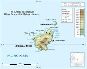
Bollons Island has a shape like a crescent moon. Its total area is about 2 square kilometers (0.77 square miles). The island is located northeast of the main island, Antipodes Island. A strait, which is a narrow water passage, separates them. This strait is about 1200 meters (3,900 feet) wide. A smaller island called Archway Island is just northwest of Bollons Island.
The island has a curved ridge that runs along its length. The highest point on this ridge is 202 meters (663 feet) above sea level. Steep cliffs surround most of the island. Only the western side does not have cliffs.
Island History
Bollons Island was named after a person named John Bollons. He was a master, or captain, of ships for the New Zealand Marine Department. His ships included the NZGSS Hinemoa and the SS Tutanekai.
Important Bird Area
Bollons Island is part of the Antipodes Islands Important Bird Area (IBA). BirdLife International has given it this special title. This is because the Antipodes Islands are very important. Many different kinds of seabirds come here to breed and raise their young.
See also
 In Spanish: Isla Bollons para niños
 | Sharif Bey |
 | Hale Woodruff |
 | Richmond Barthé |
 | Purvis Young |


