Boswell, Indiana facts for kids
Quick facts for kids
Boswell, Indiana
|
|
|---|---|
 |
|
| Nickname(s):
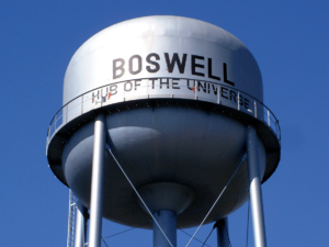
Hub of the Universe
|
|

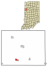
Location of Boswell in Benton County, Indiana.
|
|
| Country | United States |
| State | Indiana |
| County | Benton |
| Township | Grant |
| Founded | 1872 |
| Area | |
| • Total | 0.88 sq mi (2.29 km2) |
| • Land | 0.88 sq mi (2.29 km2) |
| • Water | 0.00 sq mi (0.00 km2) |
| Elevation | 755 ft (230 m) |
| Population
(2020)
|
|
| • Total | 800 |
| • Density | 904.98/sq mi (349.41/km2) |
| Time zone | UTC-5 (EST) |
| • Summer (DST) | UTC-4 (EDT) |
| ZIP code |
47921
|
| Area code | 765 |
| FIPS code | 18-06706 |
| GNIS ID | 2396598 |
| Website | https://www.townofboswell.com/ |
Boswell is a small town located in Benton County, Indiana, in the United States. In 2020, about 800 people lived there. It is part of the larger Lafayette area.
Contents
History of Boswell
Boswell was officially started on July 18, 1872. A man named Charles Moore first planned the town. He later sold the land to Elizabeth H. Scott and her husband Charles. They then created the town's current layout.
The town's first business was a small general store. It was in a simple building near the railroad. As Boswell grew, many more businesses opened. The town was named after Parnaham Boswell. The streets in Boswell were named after the founders, Charles and Elizabeth, and their five children: Grace, Emma, Clinton, Harold, and Jennie.
Geography of Boswell
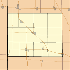
Boswell is located in Grant Township. A major road, U.S. Route 41, runs along the east side of town. State Road 352 and the Kankakee, Beaverville and Southern Railroad also pass through Boswell.
A small stream called Goose Creek flows along the south side of town. It later joins Mud Pine Creek a couple of miles to the southeast. According to information from 2010, Boswell covers an area of about 0.93 square miles (2.29 square kilometers), and all of it is land.
Population and People
| Historical population | |||
|---|---|---|---|
| Census | Pop. | %± | |
| 1880 | 330 | — | |
| 1890 | 558 | 69.1% | |
| 1900 | 824 | 47.7% | |
| 1910 | 814 | −1.2% | |
| 1920 | 880 | 8.1% | |
| 1930 | 817 | −7.2% | |
| 1940 | 877 | 7.3% | |
| 1950 | 963 | 9.8% | |
| 1960 | 957 | −0.6% | |
| 1970 | 998 | 4.3% | |
| 1980 | 810 | −18.8% | |
| 1990 | 767 | −5.3% | |
| 2000 | 827 | 7.8% | |
| 2010 | 778 | −5.9% | |
| 2020 | 800 | 2.8% | |
| U.S. Decennial Census | |||
How Many People Live Here?
In 2010, about 778 people lived in Boswell. There were 310 households, which are groups of people living together. The town had about 362 housing units in total.
Most of the people living in Boswell were White (87.9%). Some people were also African American, Native American, or Asian. About 15% of the population identified as Hispanic or Latino.
Families and Age Groups
About 33% of households in Boswell had children under 18 living with them. Many households (47.4%) were married couples. Some households were led by a single parent.
The average age of people in Boswell was about 38 years old. About 27.6% of residents were under 18 years old. About 16.2% were 65 years or older. The town had slightly more females (52.1%) than males (47.9%).
Education
The town of Boswell has a public library. It is called the Boswell Public Library. Here, people can borrow books and other materials.
See also
 In Spanish: Boswell (Indiana) para niños
 | James Van Der Zee |
 | Alma Thomas |
 | Ellis Wilson |
 | Margaret Taylor-Burroughs |


