Bower's Hill, Virginia facts for kids
Quick facts for kids
Bower's Hill
|
|
|---|---|
|
Community
|
|
| Country | United States |
| State | Virginia |
| Independent city | Chesapeake |
| Time zone | UTC−5 (Eastern (EST)) |
| • Summer (DST) | UTC−4 (EDT) |

Bower's Hill is a community found in the city of Chesapeake, Virginia. Chesapeake is an independent city in the United States. This means it acts like its own county.
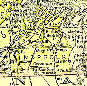
Bower's Hill is located in the South Hampton Roads area. It's near the edge of the Great Dismal Swamp. This area has flat, sandy land, typical of a coastal plain (a flat area along the coast).
Many people thought Bower's Hill was named after a highway overpass built around 1943. This overpass was part of the Military Highway. However, old maps from the early 1800s already show a place called "Bower's Hill." Records at the Library of Virginia also confirm the name existed long before the highway.
Today, Bower's Hill is known for its large system of overpasses. These connect three major Interstate highways and three other main U.S. highways. It might even be home to a future high-speed train station!
History of Bower's Hill
Bower's Hill was once part of Norfolk County, which no longer exists. It was located near the edge of the Great Dismal Swamp. As roads and railroads were built in the 1900s, Bower's Hill became an important crossroads. The land here is naturally very flat and sandy.
Around 1943, a major road called the Military Highway was built. It combined U.S. Highway 13, U.S. Highway 58, and U.S. Highway 460. This highway had four lanes and no divider. A large S-shaped overpass was built to carry traffic over the Seaboard Air Line Railroad tracks. This helped avoid dangerous crossings where roads and trains met at the same level. It also allowed for an interchange with Airline Boulevard.
The highway originally had a curve and went over the railroad on a bridge. Even though the name "Bower's Hill" existed since the 1800s, the new overpass became a famous landmark. This was especially true in the 1950s and 1960s, before the Interstate Highway System began in 1956. Because of this, many people mistakenly thought the overpasses were the reason for the name.
In 1963, the people of Norfolk County and the city of South Norfolk voted to join together. This created the new city of Chesapeake. Bower's Hill, which was still mostly rural, became a part of this new city. It is next to another area called Western Branch to its north.
Hampton Roads Beltway
In January 1997, a large highway loop was officially named the Hampton Roads Beltway. This loop is 56 miles long and includes parts of I-64 and I-664. When you look at a map, the roads going clockwise are called the Inner Loop. The roads going counter-clockwise are called the Outer Loop.
Future High-Speed Rail
The Virginia General Assembly has looked into building a high-speed passenger train service. This service would connect Richmond with the South Hampton Roads area. They found that an old train line, once owned by the Virginian Railway, could be used. This line is now owned by Norfolk Southern.
The Bower's Hill area was chosen as the best spot for a suburban passenger train station. The only other station would be in downtown Norfolk. While these plans are still being studied, Bower's Hill could become an even bigger transportation center in the future.


