Broughton Island (New Zealand) facts for kids
 |
|

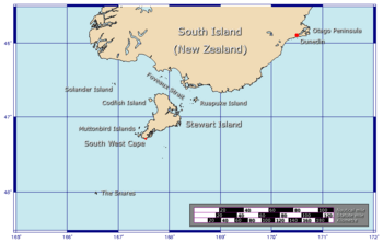
The position of The Snares relative to New Zealand
|
|
| Geography | |
|---|---|
| Coordinates | 48°02′35″S 166°37′15″E / 48.04306°S 166.62083°E |
| Archipelago | The Snares |
| Length | 1 km (0.6 mi) |
| Width | 0.5 km (0.31 mi) |
| Highest elevation | 86 m (282 ft) |
| Administration | |
| Demographics | |
| Population | 0 |
Broughton Island is a cool, small island that's part of a group called The Snares. It's the second largest island in this special group. You can find it at 48°02′35″S 166°37′15″E / 48.04306°S 166.62083°E.
Broughton Island: A Remote Spot
Broughton Island is located very far away from most people. It sits right next to the main island of The Snares, which is called North East Island. This whole island group is about 200 kilometers (that's about 124 miles) south of New Zealand's South Island. Imagine how remote that is!
Size and Shape
Broughton Island isn't very big. It's about 1 kilometer (0.6 miles) long and 0.5 kilometers (0.3 miles) wide. Think of it as being shaped a bit like a stretched-out oval, running from the northeast to the southwest. The highest point on the island is 86 meters (282 feet) above the sea. That's like climbing a tall building!
Who is it Named After?
The island got its name from a person called William Robert Broughton. He was an explorer, and many places in this part of the world are named after people who explored them a long time ago.
Part of The Snares
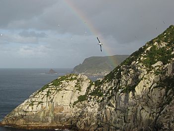
Broughton Island is an important part of The Snares. This island group is famous for its amazing wildlife, especially birds. It's a protected area, meaning humans don't live there, and it's kept safe for the animals. This makes it a really special place for nature.
 | DeHart Hubbard |
 | Wilma Rudolph |
 | Jesse Owens |
 | Jackie Joyner-Kersee |
 | Major Taylor |

