North East Island, New Zealand facts for kids

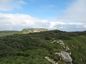
Looking to the highest point in the West, across North East Island
|
|
|
The position of The Snares relative to New Zealand
|
|
| Geography | |
|---|---|
| Coordinates | 48°01′30″S 166°36′10″E / 48.02500°S 166.60278°E |
| Archipelago | Snares Islands |
| Length | 3 km (1.9 mi) |
| Width | 2.5 km (1.55 mi) |
| Highest elevation | 130.0 m (426.5 ft) |
| Administration | |
| Demographics | |
| Population | 0 |
North East Island is the main island of the Snares Islands group. It is located about 200 kilometers (124 miles) south of New Zealand's South Island. The island has a unique triangle shape with parts that stick out like fingers to the north, south, and west. It is about 3 kilometers (1.9 miles) long and 2.5 kilometers (1.6 miles) wide.
Contents
What is North East Island?
North East Island is the largest island in the Snares Island group. This group of islands is a special place for wildlife. It is known for its many seabirds and other animals. The island is not home to any people.
Where is North East Island Located?
North East Island is found at 48°01′ South and 166°36′ East. This location is far south in the Pacific Ocean. It is part of New Zealand's territory.
What are the Island's Features?
The island's shape is like a triangle. It has three main parts that extend outwards. These are called the North Promontory, the South Promontory, and a western peninsula.
Nearby Islands and Rocks
Close to North East Island, you can find other smaller landforms. Broughton Island is the second largest island in the Snares group. It lies off the South Promontory. Near the western peninsula, there is a small rock called Alert Stack. Off the North Promontory, you will find North Daption Rock and South Daption Rock.
 | Jessica Watkins |
 | Robert Henry Lawrence Jr. |
 | Mae Jemison |
 | Sian Proctor |
 | Guion Bluford |


