Budaun district facts for kids
Quick facts for kids
Budaun district
|
|
|---|---|

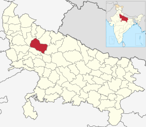
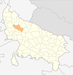
Location of Budaun district in Uttar Pradesh
|
|
| Country | India |
| State | Uttar Pradesh |
| Division | Bareilly |
| Headquarters | Budaun |
| Tehsils | 6 |
| Area | |
| • Total | 4,234 km2 (1,635 sq mi) |
| Population
(2011)
|
|
| • Total | 3,681,896 |
| • Density | 869.60/km2 (2,252.26/sq mi) |
| • Urban | 826,000 |
| Demographics | |
| • Literacy | 52.91 per cent |
| Time zone | UTC+05:30 (IST) |
| Major highways | SH33, SH43, SH51, SH18, NH 93 |
| Website | https://budaun.nic.in/ |
Budaun district is a part of Uttar Pradesh, a large state in India. The main city and headquarters of this district is Budaun. It belongs to the Bareilly division.
About Budaun District
Budaun district covers an area of about 4,234 square kilometers. In 2011, its total population was around 3.68 million people. Out of this, about 1.67 million were male and 1.45 million were female. The main language spoken by the people here is Hindi. The district has a total of 1,698 villages.
Administrative Divisions: Tehsils
A district is often divided into smaller parts called tehsils (also known as sub-districts). Budaun district has five such tehsils. These smaller areas help manage the district more easily.
The five tehsils in Budaun district are:
- Budaun
- Bisauli
- Bilsi
- Dataganj
- Sahaswan
See also
 In Spanish: Distrito de Badaun para niños
Black History Month on Kiddle
Influential African-American Artists:
 | James Van Der Zee |
 | Alma Thomas |
 | Ellis Wilson |
 | Margaret Taylor-Burroughs |

All content from Kiddle encyclopedia articles (including the article images and facts) can be freely used under Attribution-ShareAlike license, unless stated otherwise. Cite this article:
Budaun district Facts for Kids. Kiddle Encyclopedia.

