Buttermilk, Kansas facts for kids
Quick facts for kids
Buttermilk, Kansas
|
|
|---|---|

|
|
| Country | United States |
| State | Kansas |
| County | Comanche |
| Elevation | 1,896 ft (578 m) |
| Time zone | UTC-6 (CST) |
| • Summer (DST) | UTC-5 (CDT) |
| Area code | 620 |
| FIPS code | 20-09750 |
| GNIS ID | 484539 |
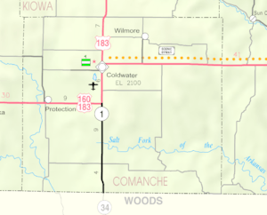
Buttermilk is a small, unincorporated community located in Comanche County, Kansas, in the United States. An unincorporated community is a place that doesn't have its own local government, like a city or town. Instead, it's usually governed by the county.
Contents
Exploring Buttermilk's History
As of 2014, Buttermilk was a very small place. It had a farmhouse, some other farm buildings, a church, and just three houses. You won't usually find Buttermilk on most road maps because it's so tiny.
What is the Big Gyp Cave Pictograph Site?
Close to Buttermilk, you can find the Big Gyp Cave Pictograph Site. This special place is listed on the National Register of Historic Places. This means it's an important historical site that the United States government wants to protect.
- Pictographs: These are ancient drawings or paintings made on rock walls.
- Why it's important: The pictographs at Big Gyp Cave tell us about the people who lived in this area long ago. They are like a window into the past!
Education in Buttermilk
Students living in the Buttermilk area attend schools managed by the Comanche County USD 300 public school district.
How Does a School District Work?
A school district is a local organization that runs public schools in a certain area. It makes sure that students have schools to go to and that they get a good education. The Comanche County USD 300 district serves all the communities within Comanche County, including Buttermilk.
 | Sharif Bey |
 | Hale Woodruff |
 | Richmond Barthé |
 | Purvis Young |


