Caer Llugwy facts for kids
Quick facts for kids Caer Llugwy |
|
|---|---|

Site of Caer Llugwy
|
|
| Location | Conwy, Wales, UK |
| OS grid | SH745572 |
| Coordinates | 53°05′51″N 3°52′27″W / 53.0976°N 3.8742°W |
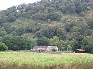
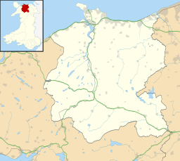
Caer Llugwy, also known as Bryn-y-Gefeiliau, is the site of an ancient Roman fort in Wales. It sits by the Afon Llugwy near Capel Curig in Conwy. This place is special because the area around the fort looks much like it did 2,000 years ago. Caer Llugwy is a protected historic site. The old fort remains are on private land.
Contents
Why the Romans Built Caer Llugwy
When the Romans took over Wales, they faced tough resistance. People living in the mountains fought back using surprise attacks. To control these areas, the Romans built many forts and roads. These forts created a network around the mountains.
A Fort for Control and Communication
Caer Llugwy was built around 90 AD. It was home to about 500 auxiliary soldiers. These soldiers were not from the main Roman legions. They helped keep order among the local people. They also controlled important travel routes. These routes went through the Llugwy Valley and nearby valleys.
Controlling Mining Operations
Some historians think the fort also helped control mining. There were mines in the nearby hills. This might explain the fort's Welsh name. Bryn-y-Gefeiliau means "Hill of the Smithies." This suggests metalworking or mining was important here.
Changes to the Fort Over Time
Around 120 AD, the fort was changed a lot. A second fort was built using stone. This new fort covered the eastern side of the old one. This left a smaller area, about 0.8 hectares (2 acres), on the western side.
The Mansio Building
This smaller western area later had a large building. It had a courtyard and is thought to be a mansio. A mansio was like a hotel or rest stop. It provided a place for travelers and officials to stay. You can still see parts of this building today. Some walls are up to a meter high.
When the Fort Was Left Behind
The Romans likely stopped using Caer Llugwy as a military fort around the mid-2nd century. However, there is some proof it was used again later. It was probably used as a posting station. This means it was a place where messages or supplies were sent. The mansio building supports this idea. Many nearby buildings and field walls were built using stones from the old fort.
 | Kyle Baker |
 | Joseph Yoakum |
 | Laura Wheeler Waring |
 | Henry Ossawa Tanner |


