Calf of Man facts for kids
|
Native name:
Yn Cholloo
|
|
|---|---|

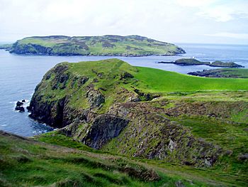
The Calf Sound, taken from direction of Cregneash
|
|
| Geography | |
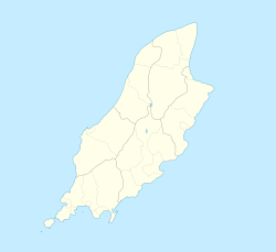
| Location | Isle of Man |
| Coordinates | 54°03′10″N 4°49′13″W / 54.05278°N 4.82028°W |
| Area | 250 ha (620 acres) |
| Highest elevation | 126 m (413 ft) |
| Highest point | Bushell's House on Or Vooar |
| Demographics | |
| Population | 3 (March to November) |
| Pop. density | 1.2 /km2 (3.1 /sq mi) |
The Calf of Man (called Yn Cholloo in Manx Gaelic) is a small island located off the southwest coast of the Isle of Man. It covers about 2.5 square kilometers (618 acres). A narrow channel of water, known as the Calf Sound, separates it from the main island.
The word 'Calf' comes from an old Norse word, kalfr. This word means a small island that lies close to a larger one. The Calf of Man is home to only a few people who live there seasonally, usually from March to November. You can visit the Calf of Man by taking a boat from Port Erin or Port St Mary. The main places to land on the island are Cow Harbour and South Harbour. The highest point on the island is 126 meters (415 feet) above sea level.
Contents
History of the Calf of Man
For a long time, until 1939, the Calf of Man was owned by a private family called the Keigs. Then, a man named Mr. F. J. Dickens bought the island. He decided to give it to the National Trust, which is a group that protects important places. His goal was for the island to become a special place for birds, a bird sanctuary.
In 1951, a new group called the Manx Museum & National Trust was created. This group is now known as Manx National Heritage. They took over looking after the Calf of Man. Since 2006, the charity Manx Wildlife Trust helps manage the island as a Calf Warden Service Provider. Manx National Heritage still owns the island.
A Home for Wildlife
The Calf of Man has been a bird observatory since 1959. This means it's a place where scientists and volunteers study birds. Many people who love birds, called ornithologists, visit the island. The observatory has basic places to stay for up to eight visitors. You can book these through Manx National Heritage.
The island is famous for its large number of Manx shearwaters. This seabird gets its name because it is often found in the waters around the Isle of Man. The Calf of Man also has a big group of seals. These seals live and have their babies along the rocky coastline of the island.
Lighthouses and Nearby Islets
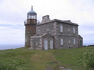
The Calf of Man and the rocks near it have four lighthouses. Two lighthouses were built in 1818 by Robert Stevenson. They were built to warn sailors about the dangerous Chicken Rocks, which are off the south end of the Calf.
Later, in 1875, a new lighthouse was built right on the Chicken Rocks. In 1968, another lighthouse was built on the Calf of Man after a big fire damaged the Chicken Rocks light. The Chicken Rocks lighthouse was later fixed and rebuilt.
There are also a few small, unfenced roads on the island and two very short streams.
Islets Around the Calf
Between the Isle of Man and the Calf, you'll find a small islet called Kitterland. Close to the Calf's shore are two other islets named Yn Burroo and The Stack. On the southern side of the island, there's a small bay called The Puddle. About a mile southwest of the Calf of Man is Chicken Rock. This is the most southerly part of the Isle of Man's land.
See also
 In Spanish: Calf of Man para niños
 | Roy Wilkins |
 | John Lewis |
 | Linda Carol Brown |


