Castle Ditches facts for kids

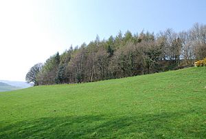
Woods around Castle Ditches
|
|
| Alternative name | Spelsbury |
|---|---|
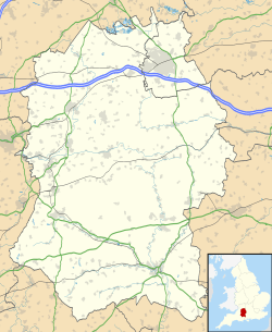
| Location | Wiltshire |
| Coordinates | 51°03′14″N 2°03′15″W / 51.0540°N 2.0542°W |
| Area | 24 acres |
| History | |
| Periods | Iron Age |
| Site notes | |
| Public access | no |
| Identifiers | |
| NHLE | 1005701 |
Castle Ditches is an ancient hillfort found in Wiltshire, England. It was built long ago during the Iron Age. This special place is located in the southeast part of Tisbury parish.
People think its old name was Spelsbury. In a document from the year 984 A.D., it was called Willburge. The fort is shaped like a triangle and follows the natural shape of the small hill it sits on.
Contents
What is Castle Ditches?
Castle Ditches is a type of ancient fort. It has three strong rows of earthworks. These earthworks are like big walls (called ramparts) and deep ditches. Today, trees cover these old walls on three sides.
The fort has a large entrance on its southeast side. This is where the hill is easiest to climb. There is also a small, narrow opening on the opposite side. The area inside the fort is about 24 acres (9.7 ha). The highest parts of the old walls are about 40 feet (12 m) tall.
What was the Iron Age?
The Iron Age was a time in history when people started using iron to make tools and weapons. In Britain, the Iron Age lasted from about 800 BC to 100 AD. During this time, people often lived in hillforts like Castle Ditches for safety.
Protecting Castle Ditches
Castle Ditches is a very important historical site. Because of this, it was made a Scheduled Monument in 1932. This means it is legally protected. It helps make sure this ancient place is kept safe for future generations to learn from.
Where is Castle Ditches Located?
This ancient site is about 1+1⁄2 miles (2.4 km) southeast of Tisbury village. The hill where the fort sits is 193 meters (about 633 feet) above sea level. From the hill, you can look down over the River Nadder valley to the north.
There are public walking paths around the outside of the site. However, the land itself is privately owned. This means you cannot go inside the fort area without permission.
Images for kids
 | Toni Morrison |
 | Barack Obama |
 | Martin Luther King Jr. |
 | Ralph Bunche |


