Castle Knowe, Kilruskin facts for kids
 |
|
| Location | North Ayrshire, Scotland |
|---|---|
| Coordinates | 55°43′03″N 4°51′41″W / 55.7175°N 4.8613°W |
| Type | Tumulus / Motte & Bailey |
| History | |
| Periods | Medieval |
| Site notes | |
| Archaeologists | John Smith |
| Condition | Cultivation damage |
| Ownership | Private |
| Public access | Yes |
| Website | Historic Environment Scotland |
| A Tumulus has also been suggested. | |
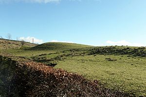
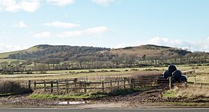
The Castle Knowe is a noticeable mound found near North Kilruskin Farm in West Kilbride, North Ayrshire, Scotland. This mound might have been used for different things over many years.
Contents
What is Castle Knowe?
The Castle Knowe has been called a small fort or a castle hill. In 1974, it was described as a motte and bailey. This means it was a type of castle with a raised earth mound (the motte) and a walled courtyard (the bailey). Records show that a stone wall was taken down in the 1890s to be used somewhere else.
There used to be a wide, deep ditch around the mound. This ditch is now hidden because the Kilruskin Burn (a small stream) was moved underground. A very old road from the Ardrossan area to Fairlie and Largs passes very close to Castle Knowe. This means a fort here could have controlled who traveled along this important route.
What Does the Name Mean?
The word 'Knowe' comes from an old English word, 'Cnoll'. It means a small, round hill or mound. Sometimes, these 'knowes' were linked to stories about fairies!
The name 'Kilruskin' might have originally been 'Kilronskan'. This could mean 'The Cell of Saint Ronskan'. People say a chapel for an unknown Saint Ronskan or Ruskin once stood at the foot of the hills east of Kilruskin. Another idea is that Kilruskin means 'The Chapel of the Rushes'. This comes from a Gaelic word 'riasg', which fits with the very marshy land between Kilruskin and Hunterston.
Early Visitors and Discoveries
In 1895, an expert named John Smith visited the site. He noted that the area had been farmed for many years. Even so, the mound was still very clear. At that time, it was about 37 paces wide at the bottom.
Early visitors thought Castle Knowe was man-made. Later experts believed it was a natural hill. However, no official archaeological digs have taken place to find out for sure.
A Place for Meetings?
An oak tree once stood on the east side of the mound. This is interesting because some people think Castle Knowe was once a moot hill. A moot hill was a place where important meetings, court cases, or justice decisions happened. It might also have been a gallow hill, where a dule tree (a tree used for hangings) was located. Castle Knowe is part of the ancient Barony of Hunterston, which had its main castle nearby.
What's Left of the Structure?
In 1816, the landowner, Mr. R Hunter, said he saw signs of an arch in the middle of Castle Knowe. It ran from North to South. In 2016, the remains of a drystone wall (a wall built without mortar) ran across the east side of the knowe. It joined another wall by the main road. An 1855 map shows a drystone wall on the western side too. We don't know where the stones for these walls came from. Today, you can't see any old structures at the site.
Castle Knowe is now a round, grass-covered mound. It's about 20 meters (65 feet) wide at the top. It's about 4 meters (13 feet) high on the North side and 2 meters (6.5 feet) high on the South. The South side looks like it has been cut into, probably by farming or when the drystone wall was built.
Was it a Burial Mound?
Some people think Castle Knowe was a tumulus, which is an ancient burial mound. When the stone walls were removed in the 1890s, an oblong (long and narrow) space was found in the center. It stretched across the whole top of the mound and was about 6 to 8 feet wide and deep. The walls of this space were neatly built with drystone. It was filled with earth and stones, but there was no sign of what had formed its roof.
Could it be a Souterrain?
Souterrains are underground passages or chambers. They are not common in the Ayrshire area. However, the description of the oblong space, especially its lack of a stone roof, makes some wonder if it could be a souterrain. These structures are mostly found in Cornwall, Ireland, and the 'Pict lands' of North-East Scotland.
What Was Found Here?
In 1896, it was reported that querns (hand mills used for grinding grain) had been found nearby. This suggests that people lived in the area a long time ago. However, even after many years of farming, the farmer reported that no other finds had been made at the site itself.
Kilruskin Toll
A toll house once stood near Castle Knowe. This was at the spot where the Kilruskin Road met the main road from West Kilbride to Fairlie. Toll houses collected money from travelers using the road.
Local History Tidbits
The Kilruskin Woods stretch up towards an old bridge that was part of the Hunterston Conveyor system.
There was also a water mill at North Kilruskin. It was powered by the Kilruskin Burn and had a mill pond. This mill used water power to grind things until the 1940s.


