Centerville, Gallia County, Ohio facts for kids
Quick facts for kids
Centerville, Ohio
|
|
|---|---|
|
Village
|
|

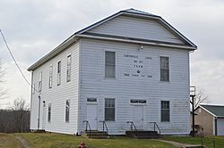
Masonic lodge building on State Street
|
|

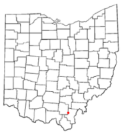
Location of Centerville, Gallia County, Ohio
|
|

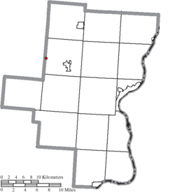
Location of Centerville in Gallia County
|
|
| Country | United States |
| State | Ohio |
| County | Gallia |
| Township | Raccoon |
| Area | |
| • Total | 0.10 sq mi (0.26 km2) |
| • Land | 0.10 sq mi (0.26 km2) |
| • Water | 0.00 sq mi (0.00 km2) |
| Elevation | 676 ft (206 m) |
| Population
(2020)
|
|
| • Total | 87 |
| • Estimate
(2023)
|
87 |
| • Density | 870.00/sq mi (335.06/km2) |
| Time zone | UTC-5 (Eastern (EST)) |
| • Summer (DST) | UTC-4 (EDT) |
| FIPS code | 39-13169 |
| GNIS feature ID | 1085657 |
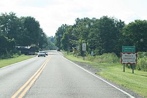
Centerville, also known as Thurman, is a small village in western Gallia County, Ohio, United States. It is located right next to the border of Gallia and Jackson counties.
You can find Centerville near U.S. Route 35 and at the start of State Route 279. It is part of the rural Point Pleasant micropolitan area. In 2020, the village had a population of 87 people.
Contents
What's in a Name?
Even though its official name is "Centerville," this village is also commonly known as "Thurman." The United States Board on Geographic Names decided that "Thurman" is also a correct name for the community. Some people even call it "Ridgeway." Its official name has also been spelled "Centreville" in the past.
Village History
Centerville was first planned out and mapped in 1835. The community was mainly settled by immigrants from Wales. They came to live and build their homes here a long time ago.
Where is Centerville?
According to the United States Census Bureau, the village covers a total area of about 0.10 square miles (0.26 square kilometers). All of this area is land, with no water.
Who Lives in Centerville?
| Historical population | |||
|---|---|---|---|
| Census | Pop. | %± | |
| 1880 | 272 | — | |
| 1890 | 215 | −21.0% | |
| 1900 | 198 | −7.9% | |
| 1910 | 143 | −27.8% | |
| 1920 | 96 | −32.9% | |
| 1930 | 127 | 32.3% | |
| 1940 | 113 | −11.0% | |
| 1950 | 142 | 25.7% | |
| 1960 | 251 | 76.8% | |
| 1970 | 114 | −54.6% | |
| 1980 | 148 | 29.8% | |
| 1990 | 128 | −13.5% | |
| 2000 | 134 | 4.7% | |
| 2010 | 103 | −23.1% | |
| 2020 | 87 | −15.5% | |
| 2023 (est.) | 87 | −15.5% | |
| U.S. Decennial Census | |||
2010 Population Details
In 2010, the census showed that 103 people lived in Centerville. There were 43 households, and 31 of these were families. The village had about 1030 people per square mile.
Most of the people living in the village were White (98.1%). A small number were African American (1.0%), and 1.0% were from two or more racial backgrounds.
Out of the 43 households, about 18.6% had children under 18 living with them. More than half (53.5%) were married couples living together. Some households had a female head (7.0%) or a male head (11.6%) without a spouse. About 25.6% of all households were individuals living alone.
Education in Centerville
Public schools in Centerville are part of the Gallia County Local School District. This district provides education for students living in the village.
See also
 In Spanish: Centerville (condado de Gallia, Ohio) para niños
 | May Edward Chinn |
 | Rebecca Cole |
 | Alexa Canady |
 | Dorothy Lavinia Brown |


